Using Remote Sensing Technology to map coral reefs from space
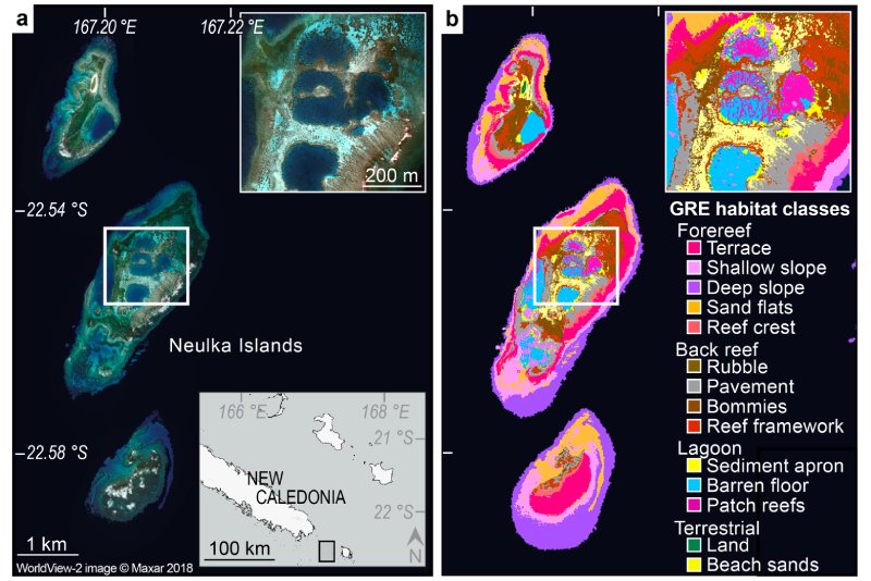
We gathered high-resolution satellite imagery and collected data in the field to create extremely detailed habitat and bathymetric maps of the ocean floor. We used this new technology to map over 65,000 km² of coral reefs and surrounding habitats on the Global Reef Expedition—by far the largest collection of high-resolution coral reef maps ever made. These types of GIS maps can help policymakers and conservation organizations develop management strategies to ensure the long-term health of coral reefs, mangrove forests, and seagrass meadows. We have also partnered with NASA, which is using our maps to train supercomputers to create high-resolution maps of the world’s coral reefs.

