Focus for today:
CASI surveys progressing very well.
Target key stage:
Key Stage 4: Double Award Applied Science; Unit 4, Science at work: instruments and machines / National Science Curriculum (Dual Award); That radio waves, microwaves, infra-red and visible light carry information over large and small distances, including global transmission via satellites.
Key information:
Owing to the fact that the ship-based and remote sening teams are operating independently of each other (in terms of geographic location), it has not been easy to gather regular remote sensing updates for the webiste. However, the scientist in charge of the CASI surveys and data collection (Herb Ripley, based out of Jizan) has recently emailed a diary of events related to this integral aspect of the Farasans Islands research project.
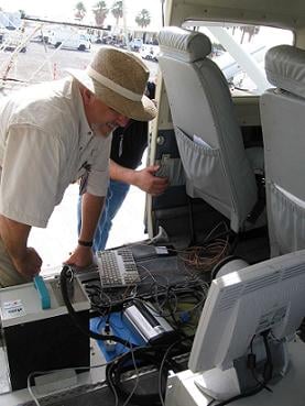
Setting up the CASI surveys
Upon arrival in Saudi Arabia, the equipment for CASI surveys was transported directly to the Golden Eye aircraft; it was then installed by Jeff and Herb. Upon completion of the installation the entire system was tested on the ground and found to be fully operational. The installation started at 0730 hrs and was completed by 0930 hrs; considering the delicate nature of the equipment and the distance it had traveled, this was a very efficient set-up.
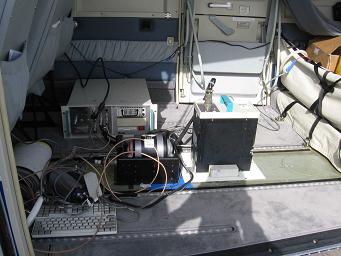
Equipment for CASI Surveys
Not only does the remote sensing team have to ensure the CASI equipment is collecting data accurately, they also have to ensure that it can be correctly processed – on an expedition such as this, the data processing is not started until the expedition is completed. However, preliminary tests on the data are done from the teams hotel room!
In order to collect data within the limited time frame of the expedition, it is vital that the remote sensing team are thoroughly prepared. Jeff and Herb spent several hours preparing ‘flight lines’ for the first areas that were to be flown/surveyed. All the flight line preparation was done digitally using a computer based Geographical Information System (GIS) and the planned flight lines transferred to a GPS system that will be used in the aircraft to assist the pilots flying the flight lines.
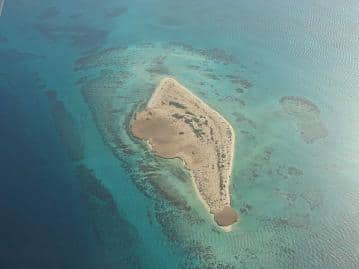
Aerial view – beautiful!
Soon after all the above was completed, the data collection started and this relies on good clear skies; fortunately our area of operation is notoriously cloud free. As a result, the weather conditions have been very good and the image data collected so far has been excellent. A simple strategy is followed each day, which ensures that the team can complete their planned flight lines and that data can been satisfactorily collected and digitally stored. Also, planning the subsequent days flying is vital. Whilst the weather here is generally very stable at this time of year, the team still have to work with a very flexible system – if the weather does not hold stable, then patience becomes a very valid attribuite to posses!
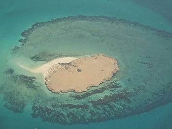
Can you see the CASI targets?
Aside from data acquisition, it is also very important to back up data that has been collected. As one might expect, the data that is collected is very valuable and the first task is to ensure that there is a double backup of all the raw data using two separate hard drives. Should the team have an unexpected hard drive failure they would not lose any data. Only upon return to the laboratory will data processing commence and habitat maps be produced in support of the sustainable management of the Farasan Islands.
Question for students/food for thought:
Can you describe for us the difference between radiance and reflectance as it relates to a remote sensing image. Does anyone know what sun glint is and how it might affect remote sensing imagery collected from an aircraft over water?
Additional information:
Can you see the CASI targets?
The Golden Shadow also received a visit from the Golden Eye; a supply of fresh provisions were offloaded, including several boxes of mango!
Tomorrow will see the expedition reach its half way point – time flies when you are having fun. The team are very happy with the progress made to date: the support the team have received from our Saudi Arabian hosts has been a significant factor in this success.