search-icon
From Space to Seabed: Researchers use satellites to analyze global reef biodiversity

This new technique can aid in coral reef protection and restoration efforts.
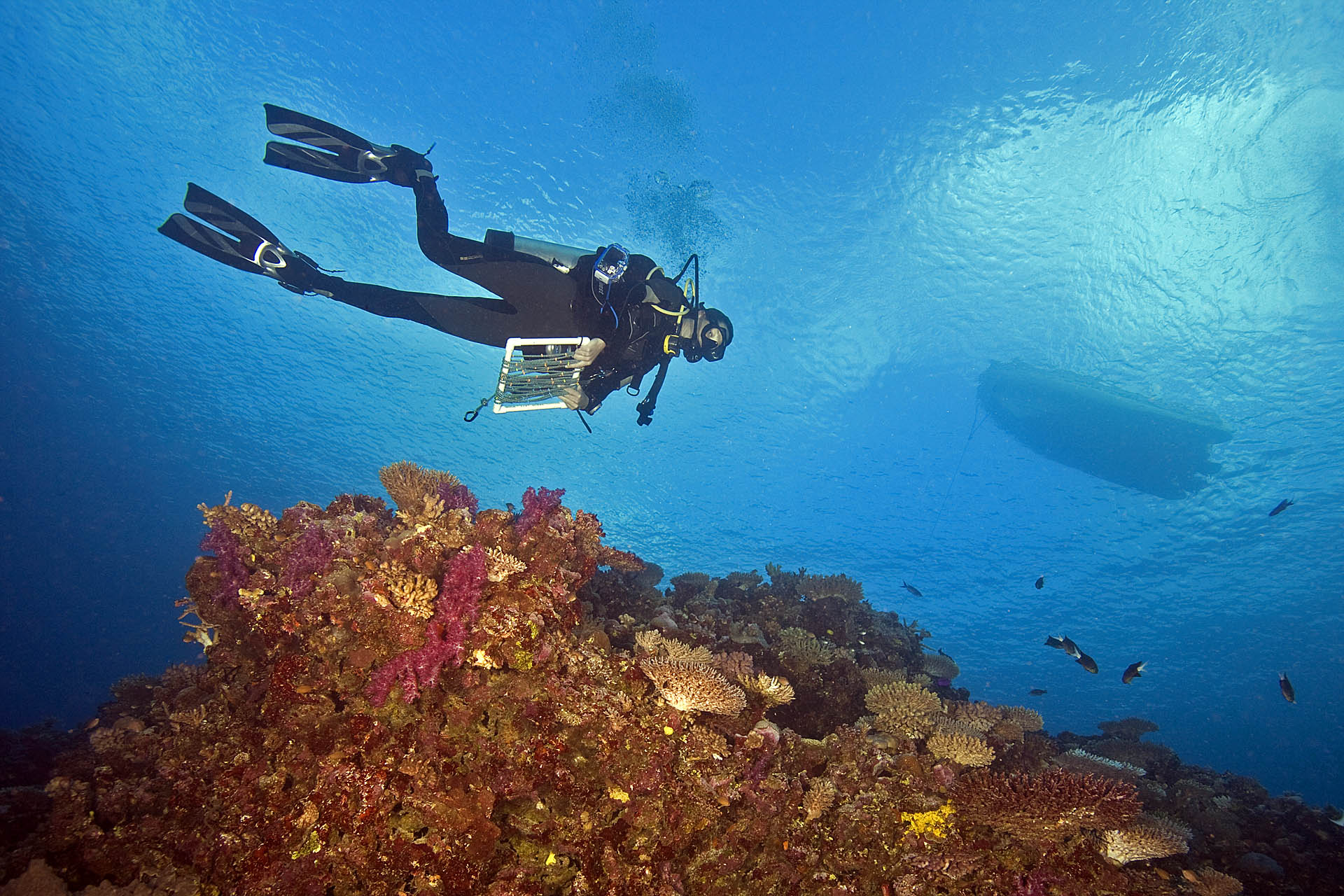
Researchers used Earth-orbiting satellites to map coral reef biodiversity at a global scale to show that areas of high habitat diversity also have high species diversity. This new satellite mapping technique, developed by researchers at the Khaled bin Sultan Living Oceans Foundation (KSLOF) and the University of Miami Rosenstiel School of Marine, Atmospheric, and Earth Science, can help guide future efforts to identify and protect highly biodiverse reefs.

“As remote sensing technology becomes more advanced, and we continue to use satellite imagery to map ecological habitats, we must understand the biological and ecological meaning of these products,” said Sam Purkis, Chief Scientist at KSLOF and Professor and Chair of the Department of Marine Geosciences at the Rosenstiel School and the senior author of the study. “We showed that these maps can be used as a proxy for biodiversity, and therefore they can be used to guide ecosystem protection and restoration.”

The conventional approach of conducting SCUBA-diver surveys to measure the biodiversity of coral reefs is both time-consuming and expensive. So, the research team set out to find a new method utilizing remote sensing to produce habitat maps at a global scale.

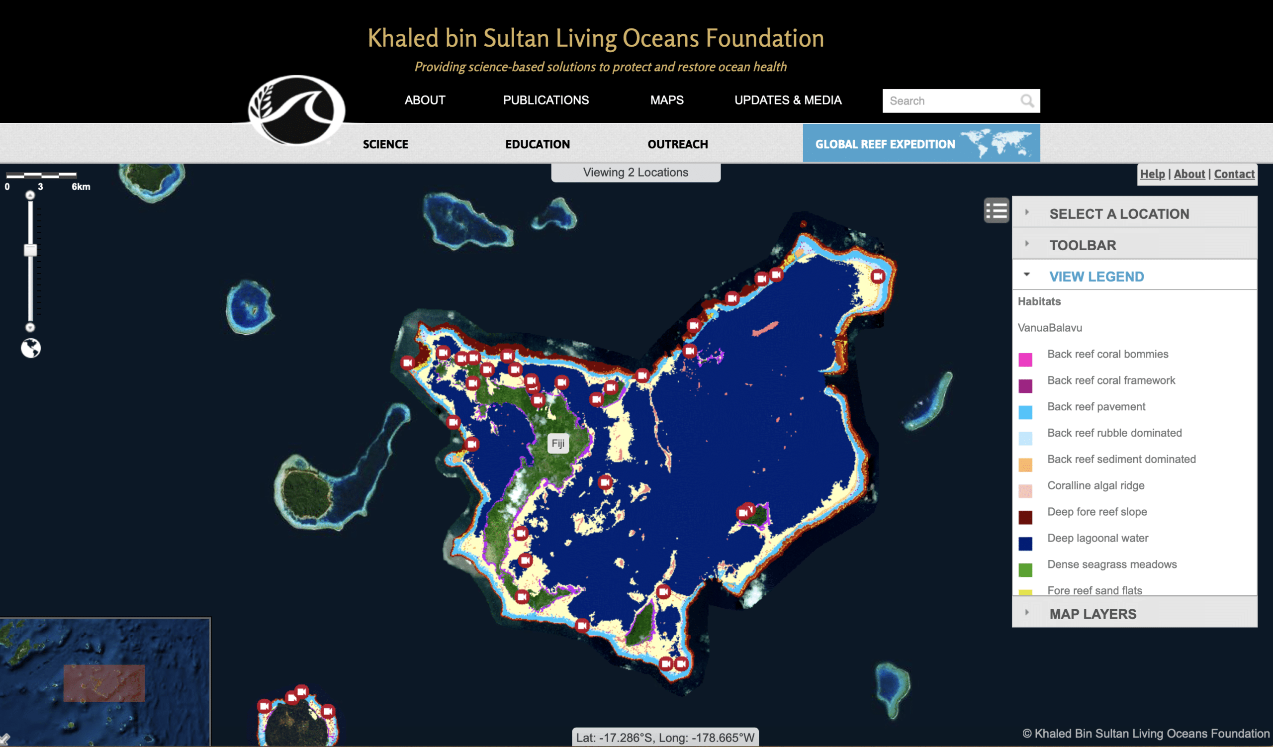
To conduct the study, they extracted the diver-measured diversity of reef fish and coral species from our Global Reef Expedition dataset, which includes data from more than 1,000 reefs across the Pacific, Atlantic, and Indian Oceans. KSLOF maps cover approximately one-quarter of Earth’s shallow-water tropical coral reefs. 
World Reef Map Coral Reef Map
The study used maps detailed habitat maps created on the Global Reef Expedition, as well as data we collected underwater using SCUBA surveys.

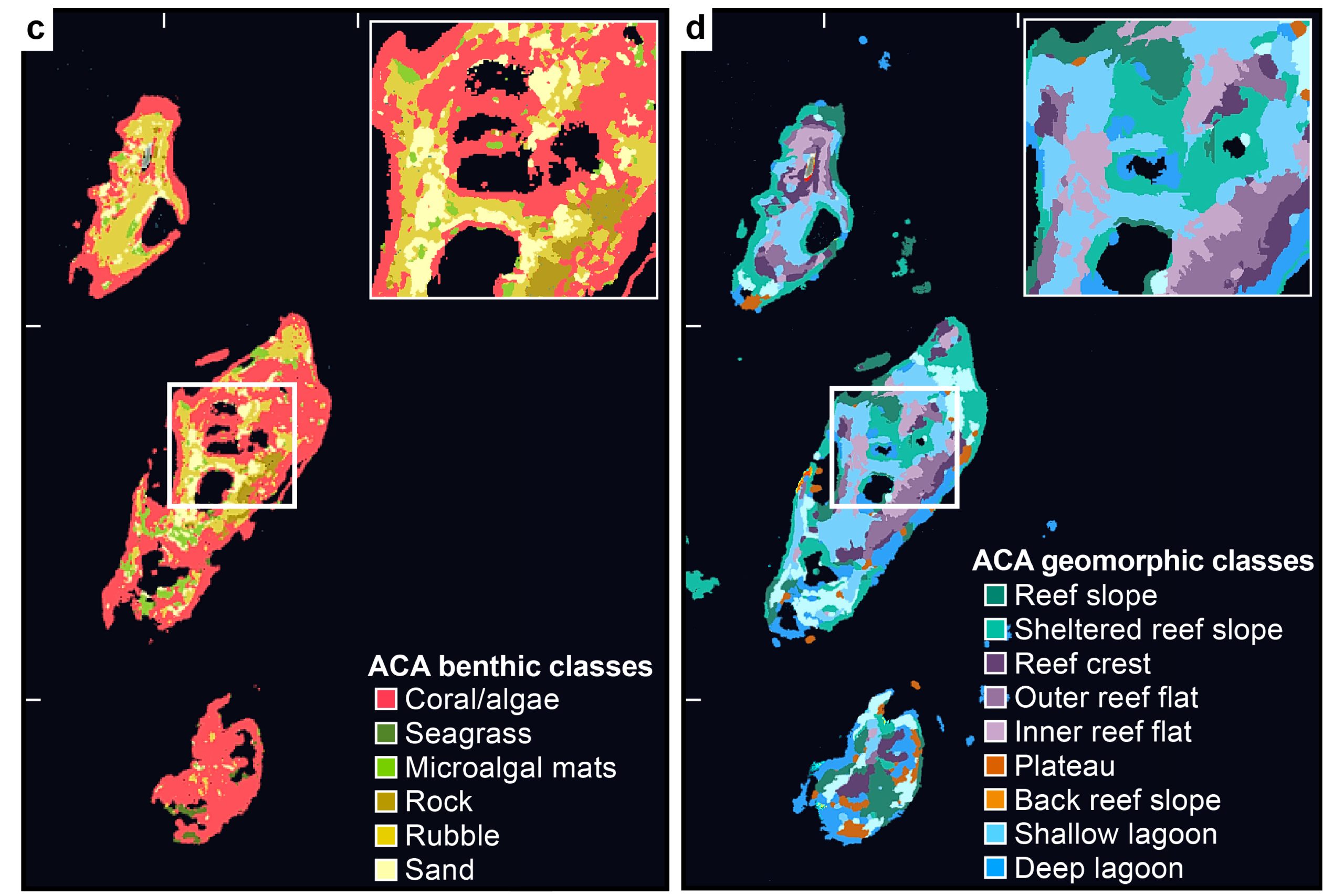
The scientists then used these maps to audit the complexity of the patterning of seabed habitats, which, they showed, to be correlated with the species diversity of the organisms that inhabited them. This relationship held across the Atlantic, Pacific, and Indian Oceans, and can therefore be used as a proxy for reef biodiversity.
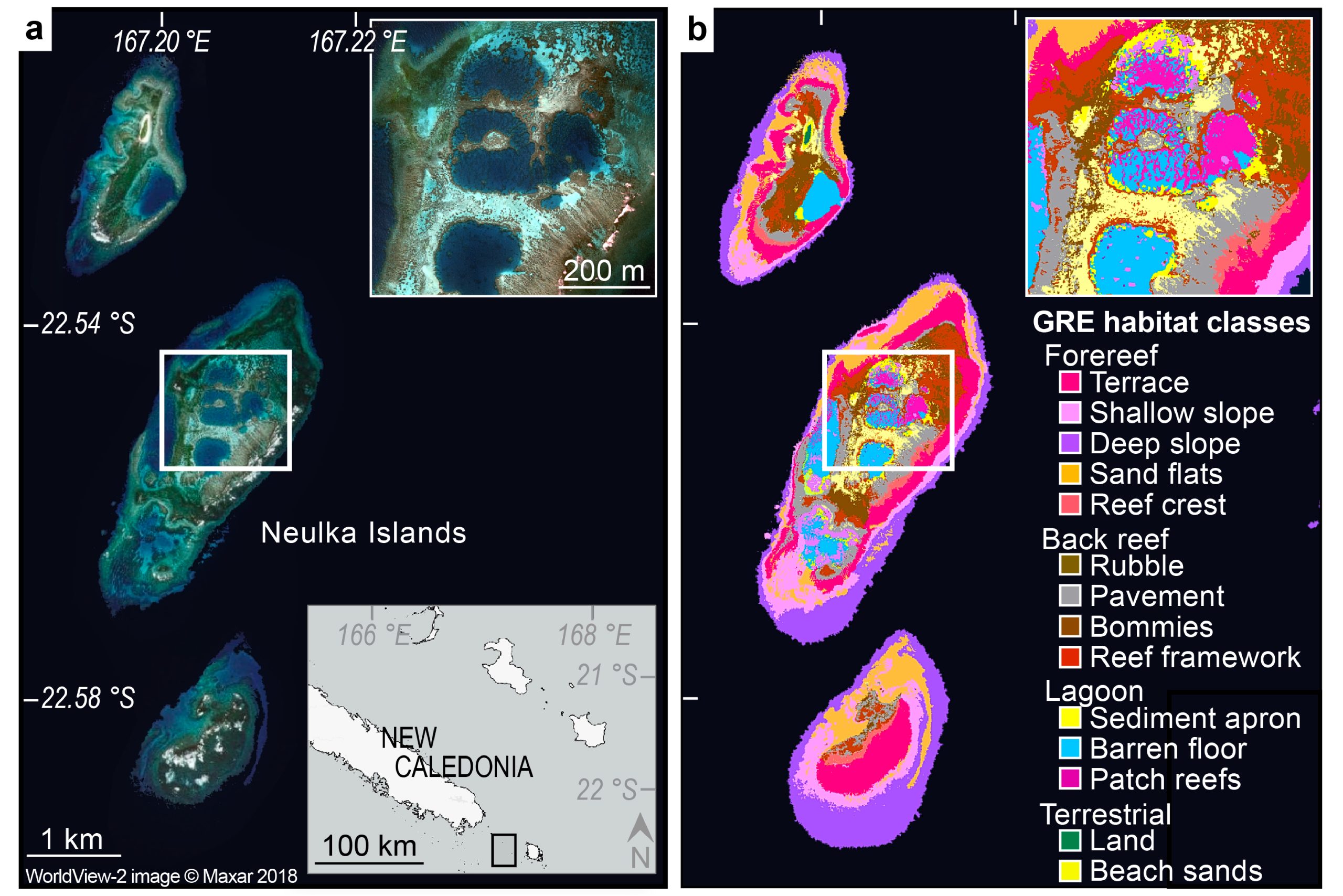
“We show how the biodiversity of these ecosystems can instead be retrieved from satellite maps of the seabed,” said Anna Bakker, a Ph.D. student in the Rosenstiel School’s Department of Marine Geosciences and lead author of the study.“ This discovery offers the opportunity of assessing reef biodiversity, at a global scale, from orbit.”

The results from this study can aid in marine spatial planning and the designation of marine protected areas to protect reefs with high biodiversity.
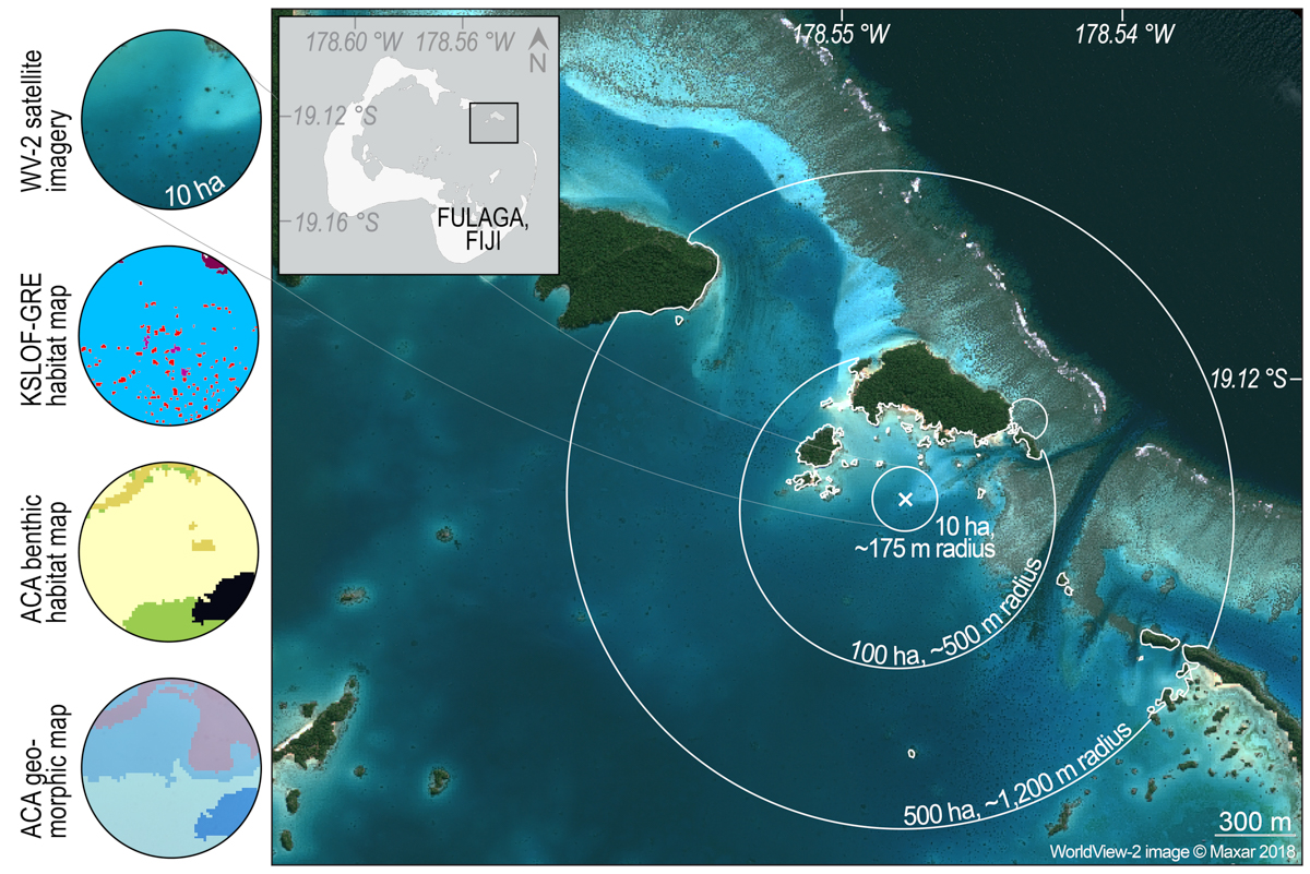
Generating dynamic habitat windows in the Fulaga Atoll (Fiji). The 10 ha insets on the left portray the satellite imagery and the three satellite map types within that area: the Khaled bin Sultan Living Oceans Foundation Global Reef Expedition (“KSLOF- GRE”) habitat maps, and the Allen Coral Atlas (“ACA”) benthic and geomorphic maps.

“The breadth and importance of the data collected on the 10-year Global Reef Expedition allowed for this truly global-scale study on the biodiversity of fish and corals in three different ocean basins,” said Alexandra Dempsey, CEO of KLSOF and a contributing author to the study.  “This study exemplifies the Khaled bin Sultan Living Oceans Foundation’s commitment to novel approaches towards coral reef conservation and its role in supplying critical data on our ocean’s reefs.”  
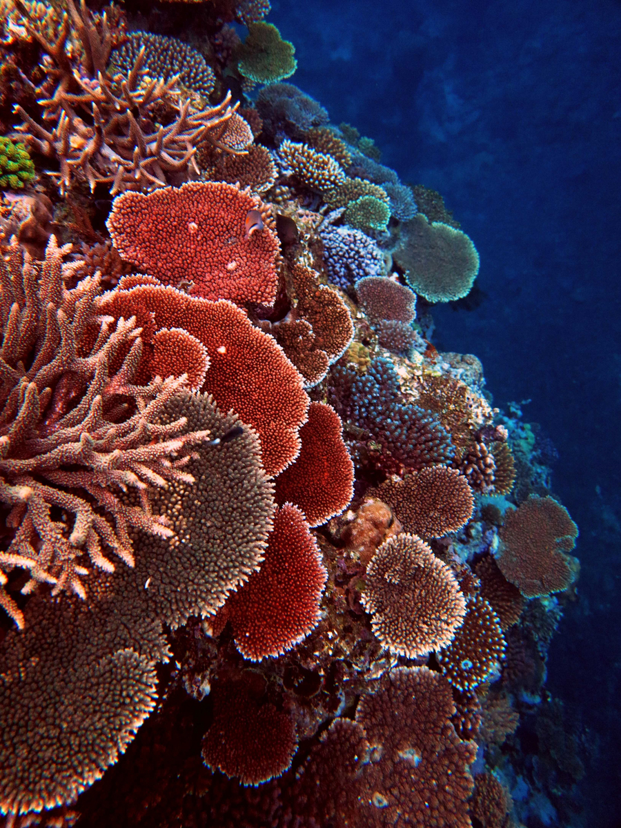
Using satellites to map coral reef biodiversity

The study, “Remotely sensed habitat diversity predicts species diversity on coral reefs,” was published in the journal Remote Sensing of Environment. The study’s authors include: Anna Bakker, a Ph.D. student in the Rosenstiel School, Sam Purkis, Chief Scientist at KSLOF and Professor and Chair of the Department of Marine Geosciences at the Rosenstiel School, Arthur Gleason from the University of Miami’s Department of Physics, Alexandra Dempsey from the Khaled bin Sultan Living Oceans Foundation, and Helen Fox and Rebecca Green from the Coral Reef Alliance. 
Related Posts

From Dialogue to Action: Ocean Foundations Gather in Stockholm

What can philanthropy accomplish when foundations working across ocean science, conservation, and sustainable development come together around a shared purpose?

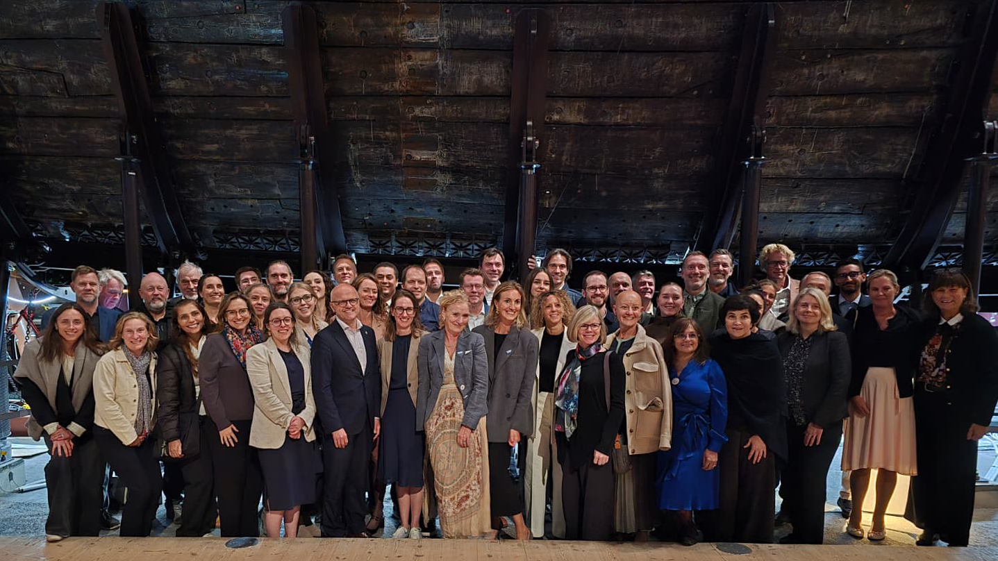
That question was at the heart of the 6th UN Ocean Decade Foundations Dialogue, held September 7–9 in Stockholm, Sweden. The Khaled bin Sultan Living Oceans Foundation joined philanthropic organizations from around the world for three days of discussion, collaboration, and planning focused on accelerating progress during the second half of the UN Decade of Ocean Science for Sustainable Development.

Facilitated by UNESCO’s Intergovernmental Oceanographic Commission (IOC), the UN Ocean Decade Foundations Dialogue is a growing network of more than 30 philanthropic organizations committed to advancing ocean science, collaboration, and action. Since its creation within the framework of the Ocean Decade, the Dialogue has provided foundations with a space to exchange ideas, develop partnerships, and explore how philanthropy can help advance a healthy and resilient ocean.

Hosted by the Voice of the Ocean Foundation (VOTO), this year’s gathering began with From Depth to Action, an Opening Forum that brought nearly 100 leaders from the Swedish and international ocean community together at…

Read More

Meet IFAN: Helping Bring Navigate with Care to the Next Generation

If you’ve ever seen a lighthouse flashing from the shore or a brightly colored buoy bobbing in the water, you’ve seen Aids to Navigation at work.

Aids to Navigation, often called AtoNs, help mariners navigate safely. They can mark channels, warn of hazards, help vessels determine their position, and provide other information people need to make safe decisions on the water. Around the world, these systems help guide everything from small recreational boats to large commercial or container ships. 

But safe navigation isn’t only about protecting vessels and the people aboard them. The choices mariners make can also affect the animals and ecosystems beneath and around them.

That connection between maritime safety and ocean conservation is at the heart of this year’s Science Without Borders® Challenge—and of our partnership with this year’s theme sponsor, the International Foundation for Aids to Navigation (IFAN).

Read More

Privacy Overview

This website uses cookies so that we can provide you with the best user experience possible. Cookie information is stored in your browser and performs functions such as recognising you when you return to our website and helping our team to understand which sections of the website you find most interesting and useful.  You can view our complete Privacy Policy here.

Strictly Necessary Cookies

Most of our cookies are used to improve website security and reduce spam. These cookies should be enabled at all times. They also enable us to save your preferences for cookie settings.

3rd Party Cookies

This website uses Google Analytics to collect anonymous information such as the number of visitors to the site, and the most popular pages. Keeping this cookie enabled helps us to improve our website.