search-icon
What Does the Seafloor of the Galapagos Look Like?

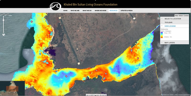
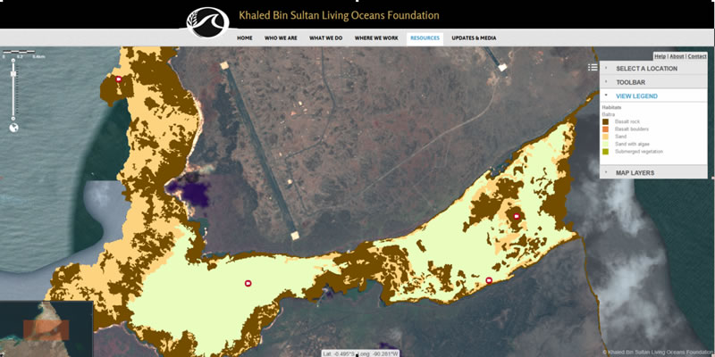
We have published the first ever high resolution seafloor habitat maps of several locations around the Galapagos Islands. They are on our map viewer, ready to explore.

As part of the Global Reef Expedition we visited the Galapagos Islands in 2012. The data we collected has been turned into extremely high resolution bethic habitat maps showing exactly what makes up the seafloor round Baltra, Darwin, Floreana, Isabela, Marchena, Urvina, and Wolf Island.  They break new ground in terms of the geographic scale of underwater mapping in the region.

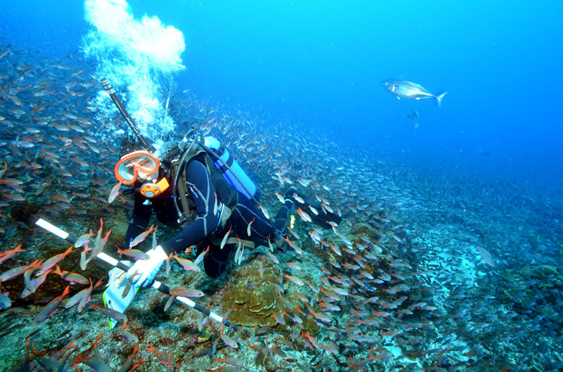
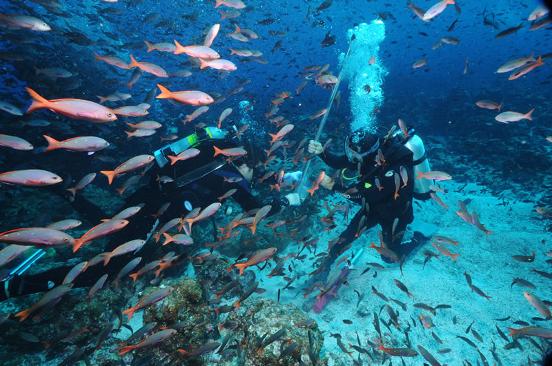
To make the maps, a team of scientists from the National Coral Reef Institute, Nova Southeastern University, conducted “groundtruthing” surveys across over 750 km2 of Galapagos seafloor. The groundtruthing team surveyed shallow marine habitats, collecting around 300 underwater videos using a tethered video camera and over a million depth readings. This map-making approach is innovative. It combines intense field effort with cutting edge satellite image analysis to categorize a satellite image into a habitat map based on properties of reflected light. You can read more about the process here.


Example of the benthic habitat map from the south of Baltra, The Galapagos Islands viewed within the Khaled Bin Sultan Living Oceans Foundation World Web Map.


The maps, describe not only Galapagos seafloor habitats, but also the water depth in the different locations.  Another cool feature of the maps is a geo referenced video layer. Camera icons on the maps show where scientists took a short video of the seafloor. By clicking on the icon you can see exactly what the seafloor looks like at that point of the Galapagos Islands.

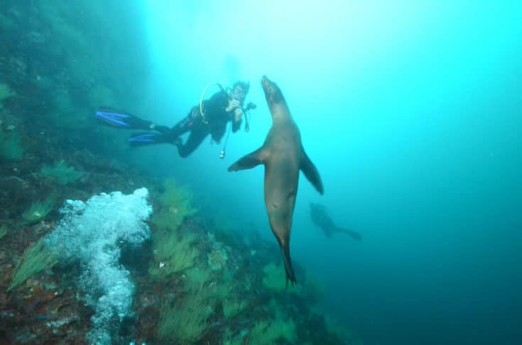
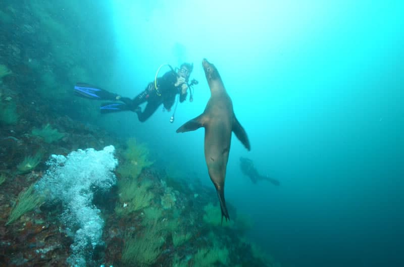
The density of marine life in the Galapagos is astounding, and created a novel challenge for the map-making scientists who are mostly  interested in understanding what was growing on or covering the seafloor. The scientists views were often obscured by dense shoals of fish.


Example of the water depth map from the south of Baltra, The Galapagos Islands, viewed within the Khaled Bin Sultan Living Oceans Foundation World Web Map.


In contrast to other reef regions we visited on the Global Reef Expedition, the Galapagos seabed  is relatively simple. The cold water and high levels of nutrients limit prolific coral reef development and we only see significant coral framework round  Darwin Island.  Elsewhere most of the hard substrate is made of basalt rocks and boulders, dominated by turf algae, macroalgae, and red calcareous algae with isolated or sparse coral cover.

You can explore the maps and download data  for all areas  of the Global Reef Expedition that we have mapped so far by exploring our web viewer.


Read our latest scientific paper from our Galapagos research.

Related Posts

After the Storm: Standing with Our J.A.M.I.N. Family in Jamaica

There are moments in this work that feel heartbreakingly familiar.

Two weeks after we completed our Jamaica Awareness of Mangroves in Nature (J.A.M.I.N.) programming, Hurricane Melissa made landfall. A powerful Category 5 hurricane, Melissa is now tied with Hurricane Allen in 1980 for the strongest winds ever recorded in an Atlantic storm. Like Hurricane Dorian, which devastated The Bahamas in 2019, Melissa will be remembered as one of the strongest hurricanes on record in the region.

For 11 years, the University of the West Indies Discovery Bay Marine Laboratory and William Knibb Memorial High School have been more than program partners. They have welcomed us into their classrooms and labs, shared meals and laughter, and committed themselves to educating their students about mangroves and coastal resilience. These colleagues and students are not distant collaborators. They are family.

And they were hit hard…

Read More

B.A.M. Turns 10: A Year of Milestones, Resilience, and Growth

The 2025–2026 academic year was one of those defining years for our Bahamas Awareness of Mangroves (B.A.M.) and Jamaica Awareness of Mangroves in Nature (J.A.M.I.N.) programs. It was a year marked by celebration, challenge, growth, and powerful full-circle moments, and a reminder of why mangrove education matters.

In The Bahamas, B.A.M. reached a major milestone: ten years of partnership and environmental education in Abaco. Since 2015, in collaboration with Friends of the Environment, we have worked alongside Patrick J. Bethel High School and Forest Heights Academy to bring hands-on mangrove science into classrooms and into the field. This year, we were proud to expand the program to S.C. Bootle High School, increasing access for students who live…

Read More
Privacy Overview

This website uses cookies so that we can provide you with the best user experience possible. Cookie information is stored in your browser and performs functions such as recognising you when you return to our website and helping our team to understand which sections of the website you find most interesting and useful.  You can view our complete Privacy Policy here.

Strictly Necessary Cookies

Most of our cookies are used to improve website security and reduce spam. These cookies should be enabled at all times. They also enable us to save your preferences for cookie settings.

3rd Party Cookies

This website uses Google Analytics to collect anonymous information such as the number of visitors to the site, and the most popular pages. Keeping this cookie enabled helps us to improve our website.