We collect enormous amounts of data and observations during our missions, a lot of which is collected in situ, or in its original place, by researchers while they’re underwater. But one of the things we do while underwater is take photographs of the reef so that we can analyze them later when we’re completely dry! Taking ‘photo quadrats’ as they’re called, or a photo of a square that we know the size of, has a couple purposes for our research. It gives us an archive of systematically collected images that captured what we saw and that we can return to, and it allows us to use computer software to analyze the reef in ways we can’t do in situ. We use free software called Coral Point Count with Excel Extensions (CPCe) to figure out what creatures make up the benthos (the seafloor), and also to calculate the surface area of each individual coral colony and estimate the area of any dead tissue or damage to the colony.
Here’s how it works.
Taking the Photograph
First we take high-resolution images of the reef contained inside a PVC square that is 100cm squared, and we put these photo quadrats down on the reef along a 10m transect line. The line is placed on the reef along a single depth contour so the depth is the same for the whole line. We take these images at depths from 5m to 30m for each site, and then post-process the images to remove distortion and sharpen the image. (Learn more about photo transects at https://livingoceansfoundation.org/pvc-paparazzi/.)
Using CPCe
The CPCe software has two basic modes, point overlay and area measurement. Point overlay is used to characterize the benthos, or estimate what percentage of each type of organism and substrate are in the image. It does this by generating random points and overlaying them on the image, and then asking the user to identify what is under each point. For each image, we generate 50 random points and we can tell the software what categories we want to use for identification. Point overlay mode looks like this:
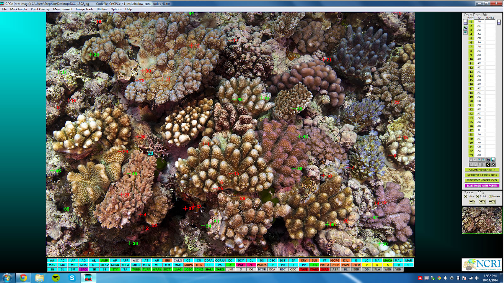
Point overlay mode using CPCe software to identify organisms.
(Click-thru on image for larger screen display.)
Using the area measurement mode, we trace the outline of each coral in the image, and also trace the outlines of any areas of dead tissue or damage. We can then tell the software what type of coral or mortality we just traced, and the software will estimate the surface area of each outlined area. Area measurement mode provides scientists with a lot of useful information. It not only tells us how much healthy surface area each coral covers, but it also gives us demographic information about the corals so we know approximately how many corals are in each age category. Just like with human populations, if we know a bit about the mortality rates in the population, we can estimate what the population will do in the future using the age structure of the corals in our images.
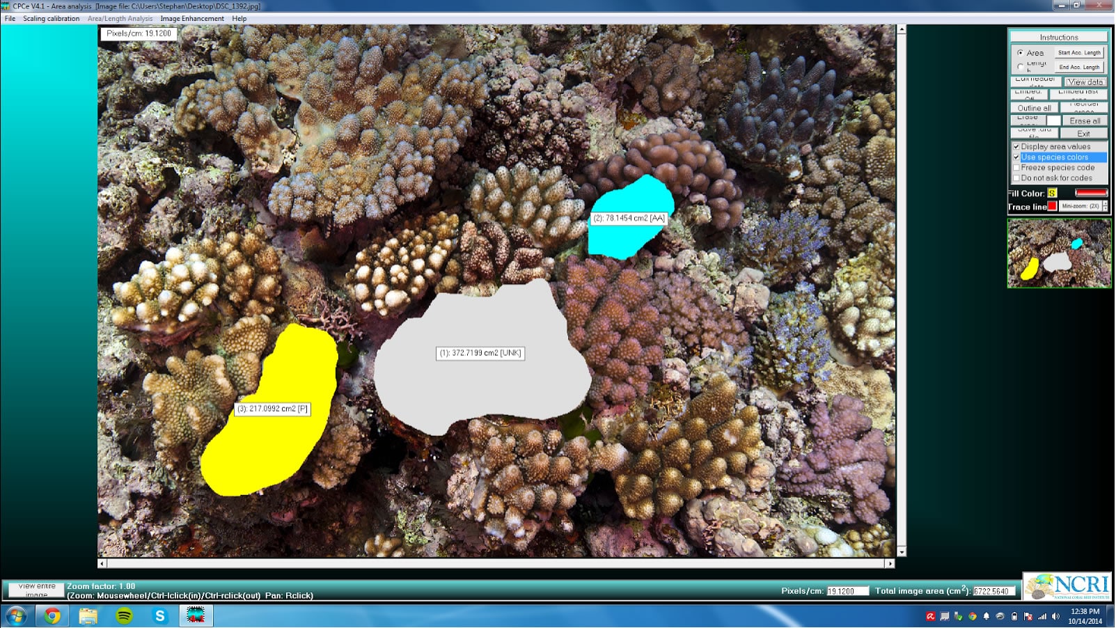
Area measurement mode using CPCe software to calculate organism surface area.
(Click-thru on image for larger screen display.)
We can collect a lot of data while staying dry, but not without our researchers getting wet first!