Published in Remote Sensing of Environment
Abstract
The ability to map coral reef biodiversity from orbit would greatly advance marine spatial planning. Presently, reef biodiversity is measured in situ by divers, but this method is inefficient and expensive. Remote sensing techniques have been developed in the terrestrial realm to lever the “habitat heterogeneity hypothesis,” which contends that the biodiversity of organisms is directly linked to the diversity of habitats which they occupy. Here, we evaluated this hypothesis using satellite-derived reef habitat maps across 880 shallow-water field stations distributed on a global transect through the Atlantic, Pacific, and Indian Oceans where we measured the taxonomic and functional diversity of reef fish and corals. Benthic habitat maps produced from WorldView-2 and PlanetScope were compared as proxies for coral reef species diversity. We found satellite-mapped habitat heterogeneity to be positively correlated with both fish (R ≤ 0.64) and coral diversity (R ≤ 0.56), at an optimum spatial scale between 110 and 320 ha, even when the data were partitioned across global biodiversity gradients. Best results were realized when using the WorldView-derived habitat maps, indicating that the enhanced spectral and radiometric resolution of this sensor is better poised for retrieving species biodiversity than PlanetScope. Our study offers an efficient method for monitoring coral reef ecosystems by leveraging satellite maps as a surrogate for species biodiversity.
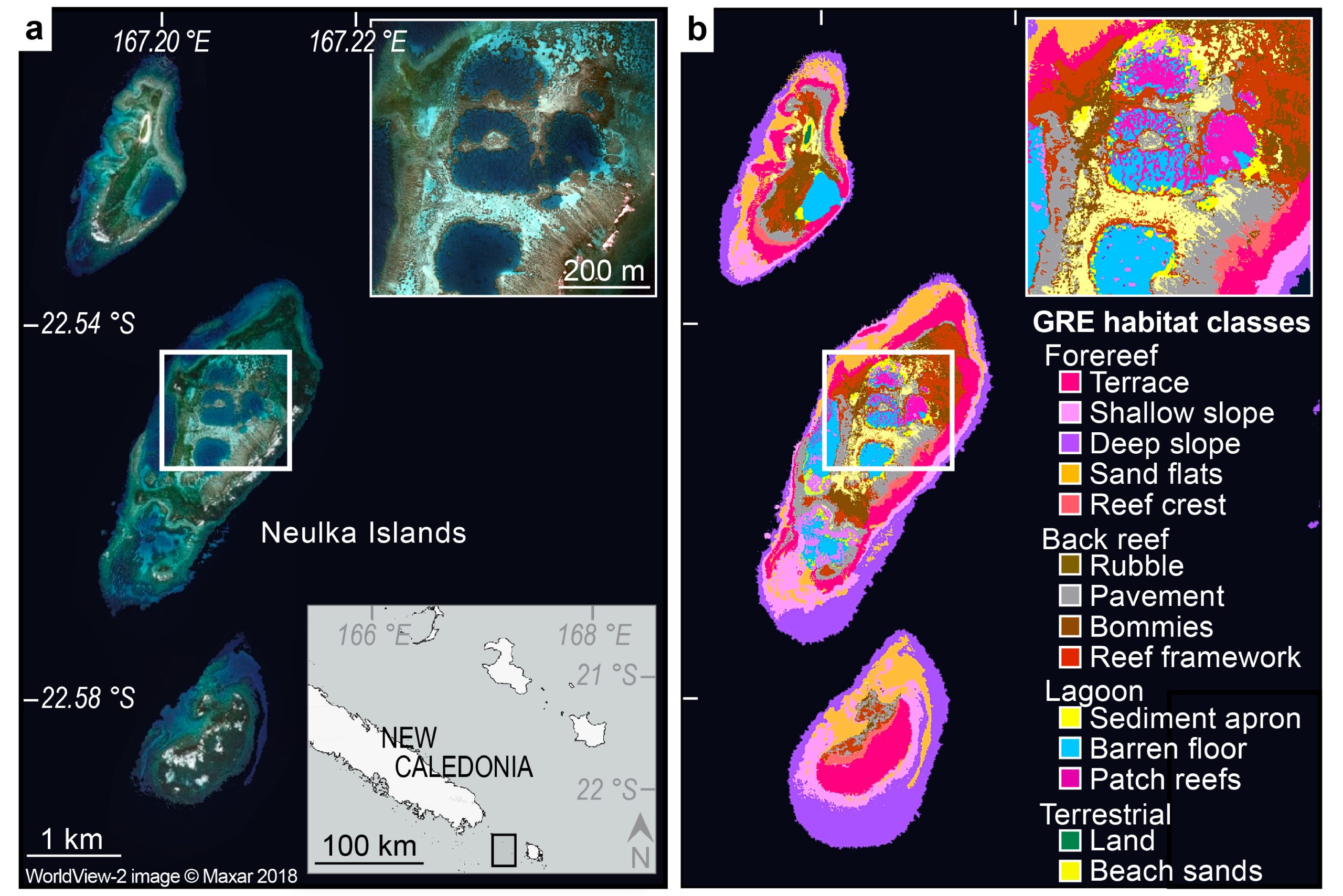
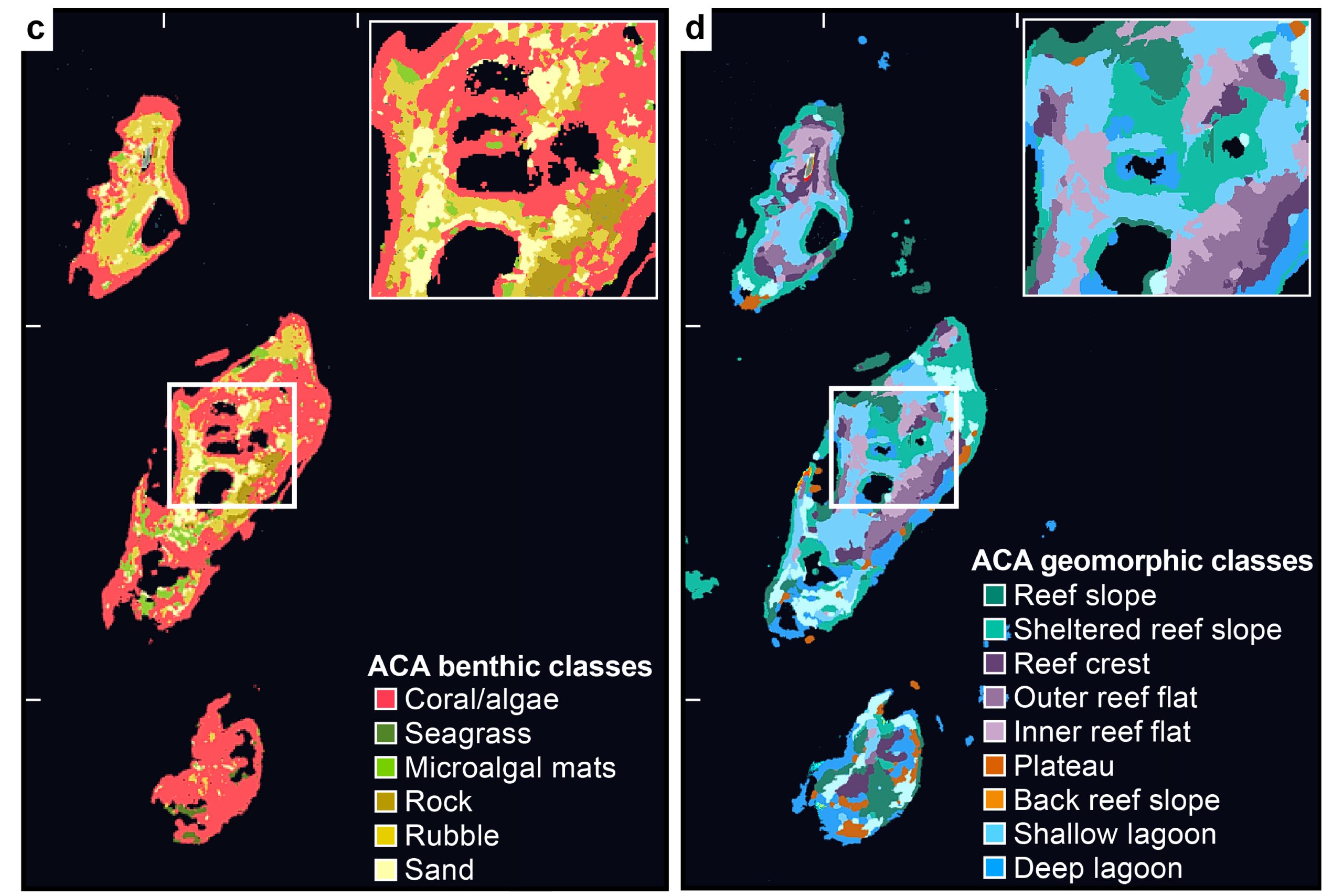
Satellite imagery of the Neulka Islands (New Caledonia), along with the three types of satellite-derived habitat maps considered in our study. (a) True-color image from Maxar WorldView-2. The Khaled bin Sultan Living Oceans Foundation Global Reef Expedition (“GRE”) benthic habitat maps for the Neulka Islands at 4×4 m resolution (b) contain 14 of the total 37 Indo-Pacific classes. The Allen Coral Atlas (“ACA”) offers two map types at 5×5 m resolution – benthic (c) and geomorphic (d). The full six ACA benthic classes are shown, while nine out of 12 geomorphic classes are present at this site.