Expedition Log: BIOT – Day 18
I’m spending the week walking the coastlines of as many of the islands of Peros Banhos atoll as I can with an accurate global positioning system (GPS). The challenge we face when extracting the position of the coastline from aerial or satellite imagery is that coconut palms and other foliage have a tendency to overhang the coastline. I’m here trying to precisely audit the contour of the coastline, even when it is obscured by trees. When I get back to the lab, I’ll use the GPS information to guide to compare the shoreline in the 1970’s to the present day in order to assess coastline erosion.
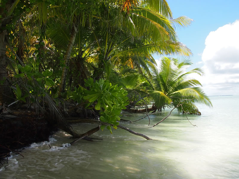
High tide on Ile Grande Soeur highlights the susceptibility of the Chagos islands to sea-level rise. Here the coastline is undercut and in the process of being lost to the Indian Ocean.
Coastlines are dynamic environments and their morphology is influenced by a host of environmental controls, including sea-level rise, on time-scales of minutes to millennia. Coral islands are low and flat with maximum elevations typically in the range of only a few meters. Being only slightly above sea level carries several implications. First, the islands are vulnerable to extreme events such as catastrophic storms as well as global environmental change and sea-level rise in particular. Second, atoll islands have small land area and few natural resources. Supplies of freshwater maybe limited, and groundwater is often brackish. Besides the damage inflicted by sea-level rise itself, coastal erosion, surface flooding, and saltwater intrusion into soil and groundwater all conspire to threaten the habitability of atoll islands around the world.
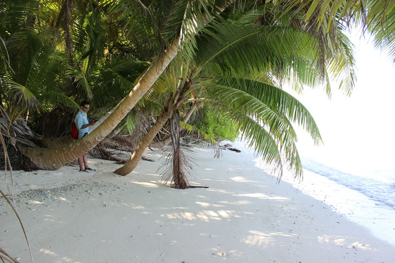
Coconut palms overhanging the coastline as I walk beneath conducting the GPS survey on Ile Poule, an island on the southwestern rim of Peros Banhos.
The project I am working on was made possible by the discovery of a set of vintage aerial photographs acquired by the US Navy in the 1970’s over the coral islands of the Chagos Archipelago. These photographs have been generously provided to us by Prof. Charles Sheppard, a collaborator on this project.
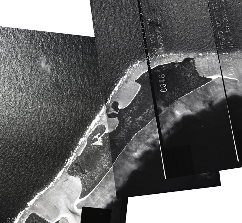
A 1973 aerial mosaic of Ile Diamant, an island situated on the northwest rim of Peros Banhos.
My aim will be to pair the archive aerial images with recently acquired ultra-high resolution Worldview-2 satellite images, also in-hand, in order to quantify the coastal shift of a series of atoll islands in the last forty years.Chagos represents a unique natural laboratory where the impact of sea-level rise on island morphology can be examined without the compounding effects of human construction. The results from this study will therefore offer insight into the natural ability of atoll islands to persist in the face of rising sea level, a question of scientific interest, but also pertinent to the millions of people who live on low-lying tropical islands. I hope that the learnings from the work will allow for a better understanding of the response of low-lying coral islands in general to sea-level change.
Photos: 1,2 – Sam Purkis.