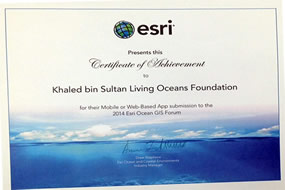
The Living Oceans Foundation World Reef Map wins 1st place in the Maps and Apps Gallery for electronic submissions at the 2014 ESRI Ocean Forum, held in Redlands, CA November 5-7, 2014. The World Reef Map is a continually growing web map interface comprised of benthic habitat and bathymetric datasets.

2025-2026 B.A.M. Student Voices
Throughout the Bahamas Awareness of Mangroves (B.A.M.) and Jamaica Awareness of Mangroves in Nature (J.A.M.I.N.) programs, we evaluate each phase of the mangrove education and restoration process to better understand how students are learning, growing, and connecting with their coastal environments.
Before the programs begin, students share what they already know about mangroves and how they feel about them. As the program progresses, we continue to gather feedback to see how their knowledge evolves from identifying mangrove species and understanding food webs to recognizing the role mangroves play in coastal protection and climate change mitigation.
But the surveys go beyond science content.
We also ask students…
