
A study published this week offers a new way to accurately map coral reefs using a combination of satellite imagery and field observations. Developed by scientists at the Khaled bin Sultan Living Oceans Foundation and the University of Miami Rosenstiel School of Marine and Atmospheric Science, this new method was used to map over 65,000 square kilometers of coral reefs and surrounding habitat. This is by far the largest collection of high-resolution coral reef maps ever made.
Over the course of ten years, scientists on the Khaled bin Sultan Living Oceans Foundation’s Global Reef Expedition traveled to over 1,000 remote coral reefs in 15 countries around the world, mapping and surveying the reefs down to a 1 square meter scale to better understand their health and resiliency. Many of the reefs visited on the expedition had never been studied before.
The high-resolution coral reef maps contain detailed information on the location and depth of different parts of the coral reef (such as the reef crest, fore reef, back reef, and lagoonal reef), as well as information on the size of seagrass beds and mangrove forests along the coast. All of these coastal habitats are key components of tropical coastal ecosystems and help to filter water, protect the coast from storms, and provide nursery habitat for commercial and subsistence fisheries. They also face increasing threats from coastal development, overfishing, and climate change.
To develop the new model to accurately map coral reefs and other tropical shallow-water marine habitats, scientists took data collected from extensive SCUBA surveys conducted on the Global Reef Expedition and extrapolated that information across the entire reef using ultra-high-resolution satellite imagery. By comparing the maps with video footage from cameras dropped at precise coordinates along the reef, the scientists were able to verify the accuracy of their new mapping method.
Learn more about this mapping method from our film Mapping the Blue:
“In order to conserve something, it’s imperative to know where it is located and how much of it you have,” said Sam Purkis, Interim Chief Scientist at the Living Oceans Foundation. “Developing such an understanding for coral reefs is especially challenging because they are submerged underwater and therefore obscured from casual view. With this study, we demonstrate the potential to use satellite images to make coral reef maps at a global scale.”
Scientists now have a way to peer beneath the waves to accurately map large areas of coral reefs at greatly reduced cost. Traditional coral reef surveys are expensive to conduct and limited in scope, requiring hours of underwater surveys conducted by highly-trained scientific divers. Now, using this new model, scientists can create detailed coral reef habitat maps at a regional scale without having to survey the entire reef in person.
“Satellite, aircraft, and drone imaging will become an increasingly important tool for addressing the coral reef crisis at the global scale at which it’s occurring,” said Purkis, who is also Professor and Chair of the Department of Marine Geosciences at the Rosenstiel School of Marine and Atmospheric Science
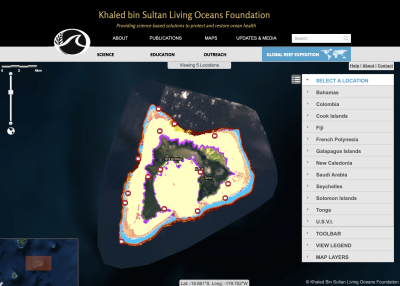
All of the high-resolution coral reef maps made for this study can be found on the World Reef Map, an interactive coral reef atlas where users can explore all of the coral reefs and shallow water marine habitats mapped on the Global Reef Expedition.
Although they by no means cover every reef worldwide, this new atlas covers a meaningful portion of key reef provinces around the world. It also provides much-needed baseline data of coral reef health prior to the 2017 mass bleaching event. This digital resource has been made available to the public so that governments and conservation organizations can use these maps to protect and restore their coral reefs for generations to come.
Scientists estimate that over 50 percent of coral reefs worldwide have been lost in the past 40 years due to climate change and other human pressures. These new detailed habitat maps can help local resource managers identify areas that may be in greatest need of conservation action.
“Benthic habitat maps are an essential tool in coral reef conservation as they provide a snapshot of where reefs are located and the status of their health,” said Alexandra Dempsey, the director of science management for the Khaled bin Sultan Living Oceans Foundation and a co-author of the paper. “Scientists will use these habitat maps as baseline data to help track changes in reef composition and structure over time.”
Few accurate maps of remote coral reefs exist, and without good maps, it is hard to protect them. The race is on to map these fragile marine ecosystems before they are gone forever. With these detailed habitat maps, local resource managers can identify areas that may be in greatest need of conservation action, so the reefs can be saved before it is too late.
The study, “High-resolution habitat and bathymetry maps for 65,000 sq. km of Earth’s remotest coral reefs” was published online on April 18, 2019, in the journal Coral Reefs.

