Early this morning, the Golden Shadow left its anchorage off Great Inagua and moved north to Hogsty Reef, one of only a few atolls in the Caribbean. The opportunity to survey such a rare Bahamian coral formation is a true highlight of this leg of the Global Reef Expedition. With a good weather forecast on the horizon, the research team opted to prioritize surveys of Hogsty Reef.
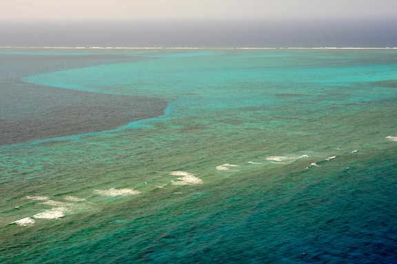
Charles Darwin first developed a hypothesis about how atolls form, describing an atoll as a more or less continuous reef surrounding a distinct lagoon. Lagoons may contain small patch reefs, as does Hogsty’s lagoon. In the Pacific, where they are far more common, atolls form when volcanic islands and the underlying subfloor, subside. As the island sinks, the fringing reefs around the island continue to grow upward becoming a barrier reef surrounding the lagoon.
Atolls in the Caribbean are typically not volcanic in origin. Scientists refer to them as “pseudo-atolls.” However, they do have true atoll characteristics: an outer reef (fore reef), a perimeter rim (reef rim) and a central lagoon. The outer reef starts in deep water with shallower portions subject to ocean swells that break around the circumference of the entire atoll. The bottom depths around Hogsty Reef reach an incredible 1800 m. Reef building corals start to grow in roughly 50 m of water, rising up to within a meter of the surface. The perimeter rim contains both reef flats and islands. Reef flats are shallow reef structures that are frequently exposed during low tides and subjected to heavy wave action. Algae encrusted coral debris is plentiful here. Waves around the rim of the atoll also form islands. On Hogsty Reef there are two sandy islands in the perimeter rim. Northwest Cay and Southeast Cay stand on either side of a gap on the western side of the atoll. The Golden Shadow is currently anchored in this gap.
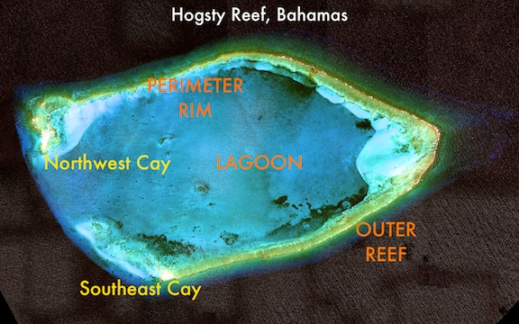
Southeast Cay, located on the southern reef rim, is less than 150 m long and 50 m wide and is about 2 m above sea level. The Cay (or island) is surrounded by bands of beach rock and wrack (seaweed, flotsam and jetsam) that have been washed up by storms. Essentially, Southeast Cay is a sand spit, with very little low, scattered vegetation. Northwest Cay, on the southwestern tip of the reef flat, is larger (~270 m long by ~65 m wide) and stands slightly higher at about 4 m above sea level. The top of the Cay is covered in low, hardy vegetation, and the ruins of an old lighthouse stand tall on the small island.
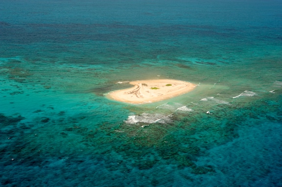
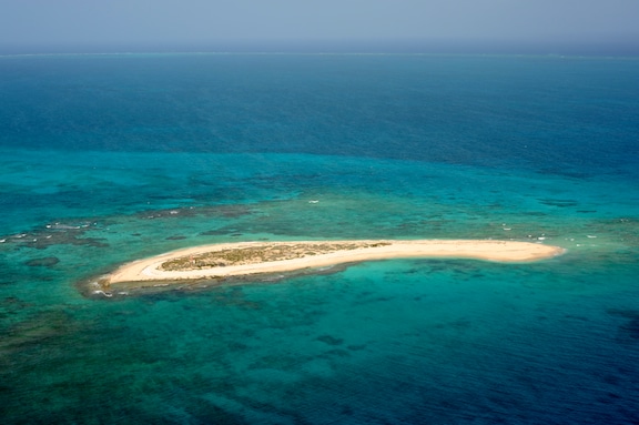
The Hogsty Reef lagoon is shallow, generally between 6 – 8 m, and measures approximately 8 km across at its widest point. The lagoon is sheltered in comparison to the outer reef and reef rim and harbors several small patch reefs.
Over the next few days, the researchers on board the Golden Shadow will have the opportunity to study Hogsty Reef in great detail. The data that emerges from this expedition will greatly expand a limited understanding of the geology, geomorphology, ecology and biology of Hogsty Reef, Bahamas.
Written by Kit van Wagner
(Photo/Images by: 1, 3, 4 CAPT Philip Renaud; 2 Satellite Image)
To follow along and see more photos, please visit us on Facebook! You can also follow the expedition on our Global Reef Expedition page, where there is more information about our research and our team members.