search-icon
Another Mission Begins: San Andres Archipelago

Last night, when most of expedition team arrived, the crew had the Golden Shadow anchored just off Jamaica’s Port Royal, at the mouth of Kingston Harbor. In the 16th and 17th centuries that was a pirate hotspot, but an earthquake submerged much of the town in 1692. Some historic remnants remain, but there was no time for sightseeing.

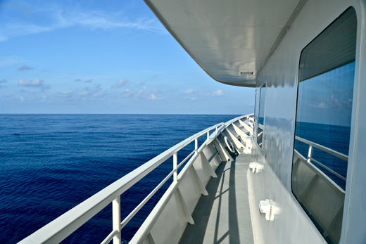
Everybody was onboard by sunset and we headed south at about 10 p.m. We couldn’t have asked for better conditions. Skies are clear, seas are flat calm, and forecasts say it should stay like this for at least a few days.


Flat calm seas
Flat calm seas

We’ve now traveled about 260 kilometers southwest of Kingston to a spot called Alice Shoal, which is jointly controlled by Jamaica and Colombia as part of a Joint Regime Zone. This is the northern tip of the San Andres Archipelago, a ring of reefs and tiny islets that stretches from where we are anchored to the inhabited island of San Andres, Colombia, roughly 400 kilometers southwest.

The Golden Shadow is situated in water so clear that we could see a stingray on the bottom today 35 meters below the surface. There’s a reef line a couple of kilometers from here, but nothing breaks the surface.


The Golden Shadow at Alice Shoal


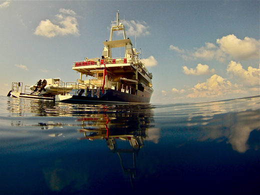
On this expedition, we’ll be exploring what are probably the most remote reaches of the Caribbean. There’s one light in the distance now, but we didn’t see any other boats all day. As we make our way around, we’ll be curious to learn how many fishermen manage to make the long journey here from Colombian islands, Nicaragua or Jamaica.

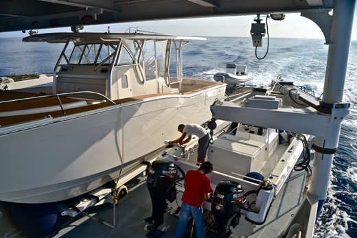
We started the day with a scuba orientation then moved on to preparations for what we hope will be a productive day of diving tomorrow. The members of the science team will be splitting into groups and heading in different directions aboard smaller boats. We’ll have people mapping the reefs, studying the conchs found in shallower waters, identifying and counting fish, and running detailed surveys of the corals.


Prepping for survey work


There is so little information available about this region that there’s no telling what we’ll find during the numerous hours we’ll be spending underwater. Check back each day for the next two weeks and we’ll let you know.

(Photos/Images by: Mark Schrope)

To follow along and see more photos, please visit us on Facebook!  You can also follow the expedition on our Global Reef Expedition page, where there is more information about our research and team members.

Related Posts

After the Storm: Standing with Our J.A.M.I.N. Family in Jamaica

There are moments in this work that feel heartbreakingly familiar.

Two weeks after we completed our Jamaica Awareness of Mangroves in Nature (J.A.M.I.N.) programming, Hurricane Melissa made landfall. A powerful Category 5 hurricane, Melissa is now tied with Hurricane Allen in 1980 for the strongest winds ever recorded in an Atlantic storm. Like Hurricane Dorian, which devastated The Bahamas in 2019, Melissa will be remembered as one of the strongest hurricanes on record in the region.

For 11 years, the University of the West Indies Discovery Bay Marine Laboratory and William Knibb Memorial High School have been more than program partners. They have welcomed us into their classrooms and labs, shared meals and laughter, and committed themselves to educating their students about mangroves and coastal resilience. These colleagues and students are not distant collaborators. They are family.

And they were hit hard…

Read More

B.A.M. Turns 10: A Year of Milestones, Resilience, and Growth

The 2025–2026 academic year was one of those defining years for our Bahamas Awareness of Mangroves (B.A.M.) and Jamaica Awareness of Mangroves in Nature (J.A.M.I.N.) programs. It was a year marked by celebration, challenge, growth, and powerful full-circle moments, and a reminder of why mangrove education matters.

In The Bahamas, B.A.M. reached a major milestone: ten years of partnership and environmental education in Abaco. Since 2015, in collaboration with Friends of the Environment, we have worked alongside Patrick J. Bethel High School and Forest Heights Academy to bring hands-on mangrove science into classrooms and into the field. This year, we were proud to expand the program to S.C. Bootle High School, increasing access for students who live…

Read More
Privacy Overview

This website uses cookies so that we can provide you with the best user experience possible. Cookie information is stored in your browser and performs functions such as recognising you when you return to our website and helping our team to understand which sections of the website you find most interesting and useful.  You can view our complete Privacy Policy here.

Strictly Necessary Cookies

Most of our cookies are used to improve website security and reduce spam. These cookies should be enabled at all times. They also enable us to save your preferences for cookie settings.

3rd Party Cookies

This website uses Google Analytics to collect anonymous information such as the number of visitors to the site, and the most popular pages. Keeping this cookie enabled helps us to improve our website.