Abstract
Introduction:
High-resolution imaging of coral reefs is critical for understanding ecosystem dynamics and guiding conservation efforts yet monitoring these changes at ecologically relevant spatial and temporal scales remains challenging.
Methods:
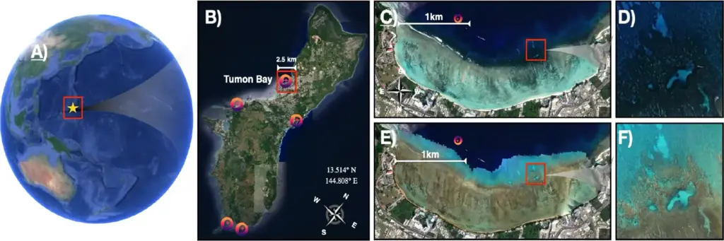
We present cm-scale benthic habitat maps for over 5 km2 of coral reefs in Tumon Bay, Guam, for 2022 and 2024, before and after Category 4 Typhoon Mawar (May 2023). NASA Airborne Fluid Lensing data were combined with in-situ ground-truthing and citizen-science annotations from the NeMO-Net platform. NeMO-Net’s original CNN was modified to an Attentive Residual U-Net (ARU-Net) with an EfficientNet-B3 encoder, class-weighted loss, and attention gating to classify seven habitat classes at pixel (cm) scale, using only ~1% of the 2022 dataset for training.
Results:
Our model achieved 88% overall pixel-scale accuracy across seven ecologically relevant benthic classes. Full-coverage habitat maps for 2022 and 2024 reveal a 59% decline in massive coral, a 35% decline in coral fore-reef, and a 105% increase in algal cover, providing spatially explicit evidence of Typhoon Mawar’s reef impact.
Discussion:
Coupling Fluid Lensing imagery with the NeMO-Net citizen-science platform and a modified ARU-Net yields accurate cm-resolved habitat assessments from sparse labels, supporting timely evaluation of disturbance and restoration outcomes in complex shallow-water reef environments.

