Maxar
August 13, 2019
By Sam Purkis, PhD, Chief Scientist of the Khaled bin Sultan Living Oceans Foundation
How the Khaled bin Sultan Living Oceans Foundation used Maxar satellite imagery to create the largest high-resolution maps of coral reefs on Earth.
The world has lost over 50 percent of its coral reefs due to climate change and other human pressures in the past 40 years. Few accurate maps of remote coral reefs exist, and without good maps, it is hard to protect them—or know what we have lost until it is gone. Detailed habitat maps can help local resource managers identify areas that may be in greatest need of conservation action, so the reefs can be saved before it is too late. For the past 11 years, I have been working with the Khaled bin Sultan Living Oceans Foundation to create these detailed coral reef maps for use in marine conservation and coastal resource management.
In 2011, an international team of scientists embarked on the Global Reef Expedition, a once-in-a-lifetime scientific mission that took us around the world to study and map coral reefs. My job on the Expedition was to create detailed maps of coral reefs and the surrounding shallow-water marine habitat. Many of the places we visited were remote reefs that had never been surveyed and mapped before.
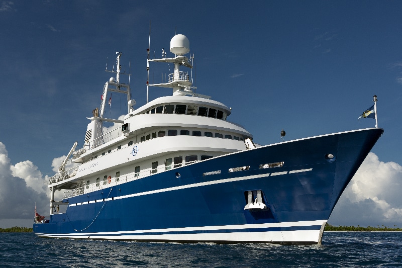
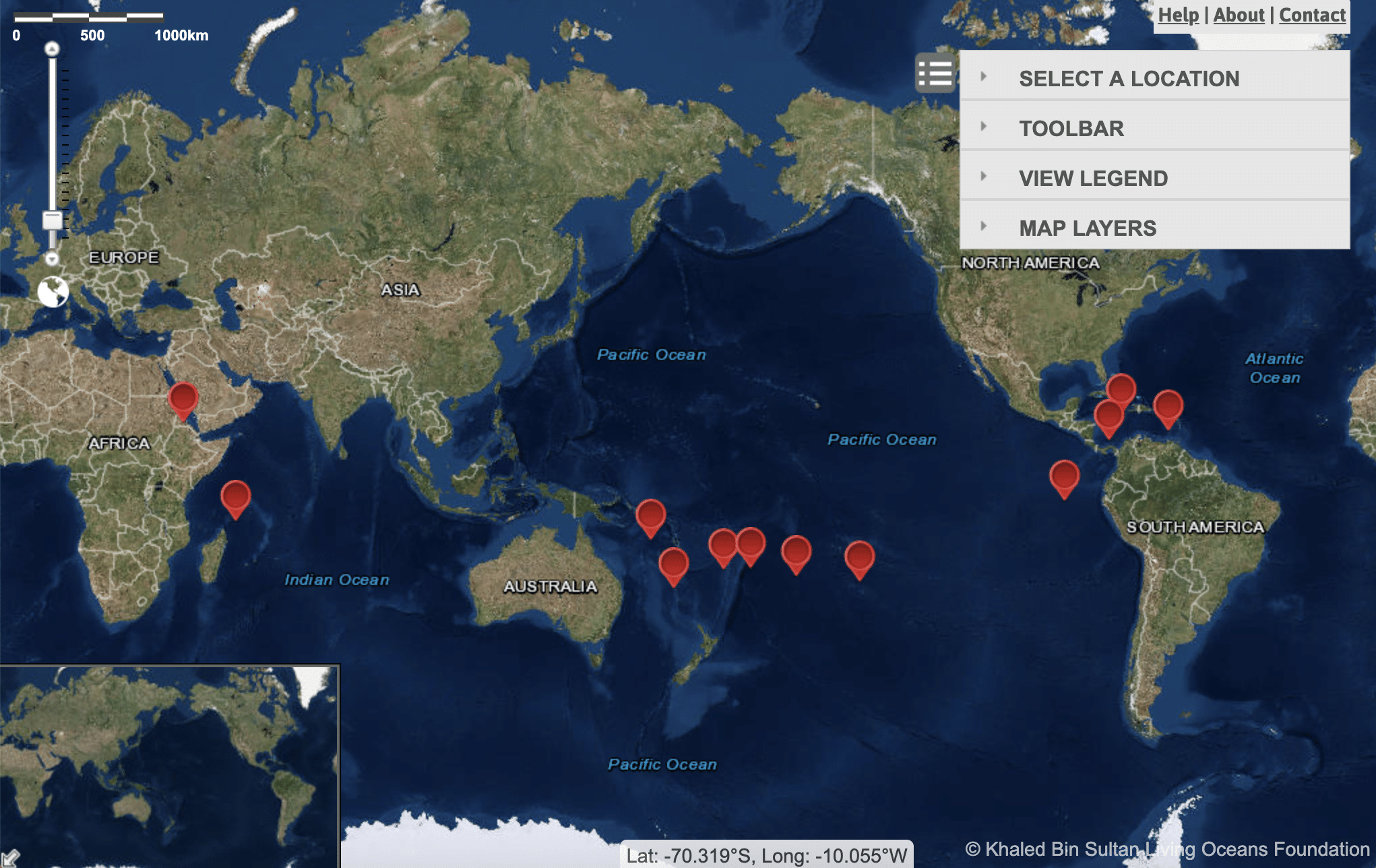
Over the course of five years, the Global Reef Expedition explored reefs in the Western Atlantic, Pacific and Indian Oceans, visiting more than 1,000 coral reefs in 15 countries. Along the way, we used a new method to map over 65,000 square kilometers of coral reefs and surrounding habitats—by far the largest collection of coral reef maps ever made.
To create these new coral reef maps, we used a combination of Maxar satellite imagery and field observations. First, we licensed 1 million square kilometers of Maxar satellite imagery covering the islands and reefs we planned to visit on the Global Reef Expedition. Maxar satellites can see up to 30 meters (about 100 feet) into clear water in blue and green colors. Blue and green light travels farther through water than red, which explains the common blue-green colors we see in the ocean. Patches of coral reefs on the seafloor can be quite small, about the size of a coffee table. To capture these coral reef features in detail and get an accurate measure of the area of coral reefs, we needed very high-resolution data, which we found in Maxar’s imagery.
With the satellite imagery in hand, we went into the field and noted what we saw beneath the waves using SCUBA surveys and video cameras. We recorded exactly what we found on the seafloor, and at what depth, and precisely marked each survey location with GPS equipment. In the process, we cataloged the unique spectral signatures of each habitat type in satellite imagery. We figured out that coral reefs have spectra that are distinct from seagrass beds, which in turn are distinct from sandy bottoms, and so on. This spectral correlation allowed us to map the entire reef and surrounding waters accurately while only taking physical surveys at certain points on the seabed. We were able to verify the accuracy of these maps using additional geo-referenced drop-cam footage that we collected at multiple locations around each reef. For more information on the exact methods we used for mapping, see our recent paper in Coral Reefs.
Now that we have developed this method and verified its accuracy in the field, we can use it to more broadly map and monitor coral reefs from space. When appropriately calibrated, Maxar’s satellite imagery can be used to map coral reefs remotely, saving the time and expense of field research, ultimately making it easier to map coral reefs in remote and hard-to-access locations. We will now have accurate coral reef maps to help us track changes over time in the size and structure of coral reefs, mangrove forests, seagrass beds and other tropical seafloor habitats.
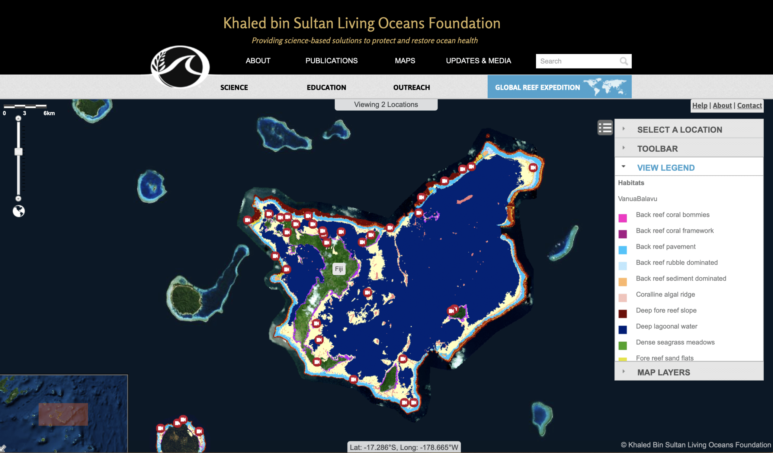
All of the maps we made can be found on the World Reef Map, an interactive coral reef atlas where users can explore all of the Living Oceans Foundation’s coral reef maps. This digital resource has been made available to the public so that governments and conservation organizations can use these maps to protect and restore their coral reefs for generations to come.
Sam Purkis is also Professor and Chair of the Department of Marine Geosciences at the University of Miami’s Rosenstiel School of Marine and Atmospheric Science