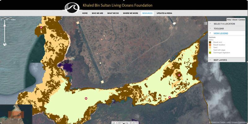
The Foundation launches its World Reef Map, a continually growing web map interface comprised of benthic habitat and bathymetric datasets collected during the various research expeditions around the globe. The map viewer makes detailed habitat and bathymetry data readily available to the global scientific community via the internet.

2025-2026 B.A.M. Student Voices
Throughout the Bahamas Awareness of Mangroves (B.A.M.) and Jamaica Awareness of Mangroves in Nature (J.A.M.I.N.) programs, we evaluate each phase of the mangrove education and restoration process to better understand how students are learning, growing, and connecting with their coastal environments.
Before the programs begin, students share what they already know about mangroves and how they feel about them. As the program progresses, we continue to gather feedback to see how their knowledge evolves from identifying mangrove species and understanding food webs to recognizing the role mangroves play in coastal protection and climate change mitigation.
But the surveys go beyond science content.
We also ask students…
