New Way to See Bahamas Underwater
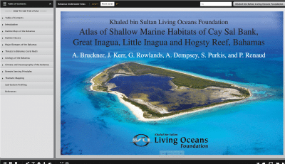 The Khaled bin Sultan Living Oceans Foundation has produced a new digital flipbook of their Bahamas Atlas. The flip book, Atlas of Shallow Marine Habitats of Cay Sal Bank, Great Inagua, Little Inagua and Hogsty Reef, Bahamas, combines advanced satellite imagery, aerial photography, and data from hundreds of research dives into the first fully interactive high-resolution coral reef atlas of many Bahamian reefs.
The Bahamas Atlas is the result of months of underwater research to survey and map life on the seafloor of The Bahamas. A team of scientists from the Living Oceans Foundation and a number of Bahamian partners including the Bahamas National Trust, the Department of Marine Resources, and The Nature Conservancy completed extensive surveys of coral reefs and associated seagrass and mangrove habitats. The research was completed as part of the Foundation’s Global Reef Expedition a 6-year mission to assess the health of coral reefs around the world.
Now, detailed maps of the findings are available in an interactive format. The flip book software converts static text into clickable, easy to navigate, and fully shareable information. The Atlas and the Foundation’s integrated GIS maps show the distribution and number of coral reefs in a region and place them in the context of human use. This can help decision makers target management actions such as the designation of marine protected areas or the establishment of marine monitoring programs.
 Using the flip book Atlas, members of the public can explore the results of the Foundation’s research in the Bahamas. Some findings of note are that for most locations surveyed in the Bahamas living coral covered between five and ten percent of the reef while green algae covered more than half. There were also signs that invasive lionfish were taking over and were proving to be one of the greatest threats to the region.
Over the past 50 years, Caribbean coral reefs have been transformed as scientists witnessed first-hand the decline of several of the most important reef-building corals, dramatic increases in algal cover, and the depletion of commercially important reef fish and invertebrate species.
“One of the fundamental tools needed to manage any geographically disbursed resource is a good map. My hope is that this Atlas, and other outputs from our surveys and mapping of Bahamian coral reefs, will be frequently consulted and used to promote sustainability of coral reef ecosystems” says Captain Philip G. Renaud, Executive Director of the Khaled bin Sultan Living Oceans Foundation. He goes on to state that “With our rapidly changing climate imposing large-scale threats on the health of coral reefs, it is critical and urgent to reduce various human-made stressors such as overfishing and pollution.”
Fortunately, many areas surveyed in The Bahamas still had healthy populations of Nassau grouper, lobsters, and conch. Some reefs still have large live boulder star corals and show signs that elkhorn coral, decimated across the Caribbean in the 1970s, have finally started to rebound. The research presented in the flip book Bahamas Atlas concludes that conservation measures, such as the establishment of no-take areas, more sustainable fishing practices, and environmentally friendly coast development are imperative to ensure the long-term health of Bahama’s coastal marine ecosystems.