Morphology and Marine Ecology of Boudeuse, Amirantes, Seychelles
The Amirantes group, Seychelles, comprises 24 islands and islets lying between 5o and 6o south of the equator on the Amirantes Bank, western Indian Ocean. The group extends over a distance of 138 km, from African Banks in the north to Desnoeufs in the south. The islands were discovered by the Portuguese navigator Vasco de Gama on his second voyage to India in 1502, soon after acceding to the rank of Admiral, and the islands were subsequently named Ilhas do Almirante or Admiral’s Islands. Boudeuse is one of the two sand cays which rise up from the Banc de la Boudeuse, approximately 60 km south-west of Poivre atoll. The other sand cay, Etoile, lies 30 km north-east of Boudeuse. The two islands are believed to have been named after the two ships of Bougainville’s circumnavigation (1766 – 1769), being explored by the Chavalier du Roslan in 1771 (Lionnet, 1970). The difficulty of landing in even calm weather, as noted by H.M.S. Alert in 1882 (Coppinger, 1885), and the lack of commercially viable guano deposits, have meant that Boudeuse has never been permanently inhabited.
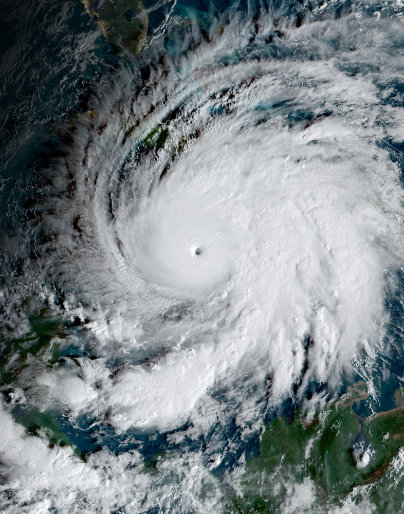
Boudeuse is small (1 ha) and isolated, being situated at the south-westernmost point of the Amirantes Bank, surrounded by water depths of 11 – 17 m but very close to water depths in excess of 1,000 m. It is approximately 200 m in length and 100 m in width, with a maximum vertical elevation of less than 5 m. The subaerial island of Boudeuse sits upon a rocky platform and displays extensive beach sandstone (Baker, 1963) (Fig. 1). The island is treeless but oblique aerial photographs taken in 2005 show that low growing vegetation is present around the outer edge and in the centre of the island (Plate 1). There are two small saline ponds in the western part of the island. The terrestrial vegetation is interspersed with coral sandstone, which is more extensive in the east of the island. Coral boulders occur on the western beaches and at the southern point.
Boudeuse is thought to be one of the last two strongholds of Sula dactylatra (Masked Booby) in the Seychelles, with 3,000 – 5,000 pairs breeding there annually (Stoddart, 1984a). The island is protected under the Wild Birds Protection (Nature Reserve) Regulations of 1966 but law enforcement is extremely difficult as the island has no human presence to report the activities of poachers (BirdLife International, 2008). In July 1955, it was estimated that there were around 5,000 birds present (Ridley and Percy, 1958). In 1976, 7,000 birds (representing ~3,000 pairs) were estimated on the island at all stages of breeding, but mostly with large chicks. However, Feare noted a pile of corpses left by fishermen and soon after his visit many of the fledglings that he had banded were killed (Feare, 1978).
A collaborative expedition between Khaled bin Sultan Living Oceans Foundation, Cambridge Coastal Research Unit and Seychelles Centre for Marine Research and Technology – Marine Parks Authority to the southern Seychelles was conducted onboard M.Y. Golden Shadow, from 10th – 28th January 2005. The primary aim of the expedition was to use a CASI (Compact Airborne Spectrographic Imager) sensor onboard a seaplane to conduct large-scale mapping of the southern Amirantes, Alphonse/St. Francois (Spencer et al., 2009) and Providence Bank. Following an initial reconnaissance, it was deemed unsafe to land on Boudeuse but shallow marine surveys were undertaken on 25th January 2005.