Red Sea Atlas
(2013)
 Over a four year period, the Living Oceans Foundation has been involved in a massive scale marine habitat research project in the Red Sea. The results are now published in this first-ever atlas of the Red Sea marine habitats and offshore coral reefs. It is available for download in both English and Arabic.
Preface
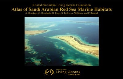
This Atlas represents one of the main products generated from four years of research along the Red Sea coastline of the Kingdom of Saudi Arabia by the Khaled bin Sultan Living Oceans Foundation in conjunction with several government and academic partners. The main goals of this project were to map shallow marine habitats off the Saudi Arabian Red Sea coastline and characterize their structure, composition, and condition and provide the resulting information and tools to relevant government agencies in Saudi Arabia as a baseline for future management and conservation initiatives, groundtruthing surveys, and research efforts focused on the Farasan Islands (2006), Ras Qisbah (2007), Yanbu and Al Wajh regions (2008), and the Farasan Banks (2009). The areas were chosen because they represent the most complex marine environments in the region, with shallow habitats often extending 30-100 km offshore. Other less complex areas are not included in this Atlas, primarily because these are dominated by fringing reefs located close to shore that drop quickly into deep water.
This Atlas builds on an earlier study commissioned between 1998- 99 by the Japan International Cooperation Agency (JICA) and the Saudi Wildlife Commission (SWC). The former study produced habitat maps of 1:10,000 scale for the northern Red Sea coast of Saudi Arabia, prepared through analysis of aerial color photographs and groundtruthing. Prior to this work, marine surveys and expeditions in the Red Sea started as early as 1761 with the work of Arabia Felix(Danish) (1761—67), followed by other several expeditions, namely: Vitiaz (USSR) 1886-89; Valdivia (GER) 1898-99; Pola (Austria) 1895- 98; A. Magnaghi (Italy) 1923-24; Snellius (GER) 1929-30; Mabahiss 1933-34 and 1934-35; Albatross (Sweden) 1948; Manihine 1949 and 1952; Calypso (Greece) 1955; Atlantis and Vema (USA) 1958; Xarifa(Austria) 1961; G. Challenger (USA) 1971; Valdivia (GER) 1971-72; Sonne (GER) 1997; Meteor (GER) 1961, 1999, 2002; Urania (Italy) 2005; Oceanus (KAUST) 2008; Aegaeo (KAUST) 2010; Poseidon (KSA & GER) 2011; and Aegaeo (KAUST) 2011—ongoing.
These historical explorations were mainly designed and executed with the principle aim of collecting biological samples for natural history museums. The work of the Foundation is different and more sophisticated, combining satellite-based multispectral sensors, aircraft- based hyperspectral sensors, boat-based echosounders, and state-of-the art scuba assessments.
The available equipment in the research ship, Golden Shadow, including dedicated laboratory facilities and an embarked amphibious aircraft, Golden Eye, has allowed extensive aerial hyperspectral surveys of coral reef ecosystems and other state-of-the-art surveys. Remote sensing is the foundation upon which this Atlas is built. Remote sensing is the science of acquiring information about an object or surface without direct physical interaction with it. In the simplest case (passive remote sensing), a sensor detects reflected or emitted electromagnetic radiation from natural sources, such as the Sun. The best example is a photograph, typically created by a camera, which uses a lens to focus visible light reflected off of an object onto a light-sensitive surface. More involved technologies, so called active approaches, require a signal to be emitted and then a return signal measured. Radar is such an example, where an electromagnetic pulse is emitted by the instrument, and the energy reflected back off of the target is subsequently recorded.
Remote sensing approaches used in this study include satellites, aircraft, boat-mounted tools, and diver-operated tools. Each instrument has its own inherent advantages and disadvantages. Used judiciously, the fusion of these remote sensors provides the basis for accurate shallow seafloor mapping in tropical coral reef environments. Field data collection, commonly referred to as “groundtruthing,” was necessary to facilitate the production of robust and regional-scale coral reef maps with a high degree of accuracy. Data acquisition focused on water depth soundings, optical measurements, and accurately located habitat census. Geographic positioning, through use of differential Geographic Positional System (GPS) technology provided the means to link remote datasets with information collected on the ground.
All fieldwork was carried out using the 67 m M/Y Golden Shadow, and its various support vessels, generously donated by HRH Prince Khaled bin Sultan of the Kingdom of Saudi Arabia. The Golden Shadow is a safe and highly capable vessel for accessing remote reef environments. A hydraulic platform that can be submerged and raised clear of the water and numerous other lifts, facilitate the rapid deployment of a fleet of small boats.
It is hoped that the information contained herein will be incorporated into marine spatial planning and ecosystem management plans for the coral reefs of Saudi Arabia. These maps provide landscape-scale guidance to decision makers on the location and diversity of habitats and possible locations to target for management. In addition, the maps form a basis from which to assess future changes to these habitats resulting from coastal development, restoration, and the impacts of climate change. It is important to treat these habitat maps as living documents. The authors and the Khaled bin Sultan Living Oceans Foundation would be delighted to incorporate new and revised information into updated printings of the Atlas.