Researchers use satellites to analyze global reef biodiversity
(2024)
In Phys.org
February 10, 2024
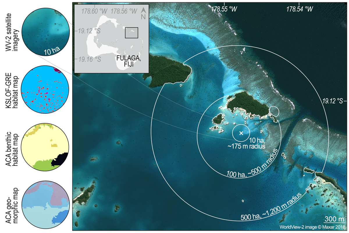
Researchers used Earth-orbiting satellites to map coral reef biodiversity at a global scale to show that areas of high habitat diversity also have high species diversity. This new satellite mapping technique can help guide future efforts to identify and protect highly biodiverse reefs, according to the University of Miami Rosenstiel School of Marine, Atmospheric, and Earth Science research team that conducted the study.
“As remote sensing technology becomes more advanced, and we continue to use satellite imagery to map ecological habitats, we must understand the biological and ecological meaning of these products,” said Sam Purkis, Cheif Scientist at the Khaled bin Sultan Living Oceans Foundation and Professor and Chair of the Department of Marine Geosciences at the Rosenstiel School and the senior author of the study. “We showed that these maps can be used as a proxy for biodiversity, and therefore they can be used to guide ecosystem protection and restoration.”