Eco Magazine
Special Issue: Sea Level Rise
July 19, 2021
Following the discovery of a rich portfolio of vintage aerial photographs of the atoll islands in the Chagos Archipelago from the 1960s, scientists are learning how the coastline of these uninhabited tropical islands have changed over time—and how they are responding to rising seas.
By Liz Thompson
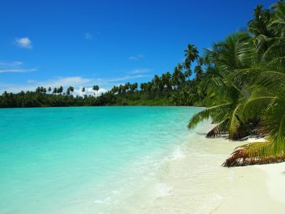 Thousands of miles away from the nearest continent, in the middle of the Indian Ocean, lie the atoll islands of the Chagos Archipelago. These are truly some of the last wild and untamed islands on Earth. Largely uninhabited, Chagos is one of very few places in the world where scientists can study an island’s natural behavior, or how they move and change over time. Understanding how islands evolve and keep pace with sea level rise has profound implications for the millions of people worldwide who live on low-lying coral atolls.
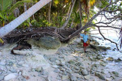
Atoll islands are not as immobile as they may first seem. Over time, waves and wind shape the island, shifting sand and moving coastlines. This is particularly true for islands situated atop the rims of coral atolls like those in the Chagos Archipelago. These islands are built on the ruins of ancient reefs, their pristine sand beaches are the erosional remnants of ancient corals that once rimmed the shore.
Atoll islands are low and flat, typically rising only a few feet above sea level. This makes them particularly vulnerable to sea level rise. Besides the damage inflicted by the rising sea itself, corresponding increases in coastal erosion, surface flooding, and saltwater intrusion into soil and groundwater all conspire to threaten the habitability of atoll islands around the world.
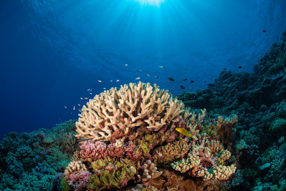
In 2015, researchers with the Khaled bin Sultan Living Oceans Foundation (KSLOF) traveled to the Chagos Archipelago to survey and map coral reefs as part of their Global Reef Expedition. The primary goals of this research mission were to assess the state of the reefs and create high-resolution maps of the coastal marine ecosystems surrounding islands in the archipelago. Dr. Sam Purkis, KSLOF’s Chief Scientist as well as Professor and Chair of the Department of Marine Geosciences at the University of Miami’s Rosenstiel School of Marine and Atmospheric Science, led the mapping effort. In the process of mapping the coastal marine ecosystems in Chagos on the Global Reef Expedition, Dr. Purkis had assembled detailed geographic information on the islands’ shoreline at the time of the Expedition.
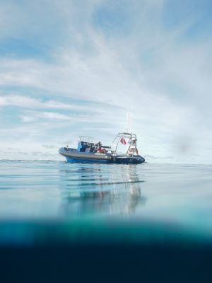
Dr. Purkis had the enviable job of walking the shoreline of many of the small islands of Peros Banhos atoll with a very accurate global positioning system (GPS) device. One of the problems with creating shoreline maps from satellite imagery is that trees often obscure the shore. This process allowed Dr. Purkis to precisely contour the coastline under the palm trees. Peros Banhos is one of the few places left on Earth where scientists can study the behavior of atoll islands in the absence of coastal development—only one of its 23 islands has ever been settled by humans. This was the first time field data was collected for the purpose of generating satellite maps for the shallow waters of the archipelago.
With the discovery of a rich portfolio of vintage aerial photographs for the Chagos Archipelago taken by the U.S. Navy in 1963, Dr. Purkis and his M.Sc. student, Ms. Mingyue Wu, knew they had a chance to study how the islands were changing over time and how they were coping with rising seas. Using the data Dr. Purkis collected on the Global Reef Expedition, Mingyue was able to track the behavior of these wild islands over the past 50 years. Pairing the vintage photographs with modern satellite imagery, the team was able to study the islands’ shifting coastlines to understand how low-lying atoll islands respond to rising sea level.
They found that the islands in the Chagos Archipelago were not shrinking. They were keeping up with sea level rise. The islands were highly dynamic, getting smaller in some areas while growing in others. Shorelines were moving with the prevailing wind and waves, but the islands remained essentially the same size they were 50 years ago.
One of the reasons this may be is that, until recently, these islands are surrounded by healthy coral reefs, which provided enough material for the islands to maintain their size over decades. Much of the sediment that nourishes the Chagos Archipelago’s coastlines comes from the healthy reefs that mantle the islands. Declines in reef vitality, as has occurred in the last five years, can serve to starve beaches of sediment, amplifying coastline retreat and increasing the chance that islands cannot keep pace with rising seas. Their remote location naturally protects the reefs in the Chagos Archipelago, but they are also protected by a very large marine protected area (as well as the presence of the naval base on the one developed island in the archipelago, Diego Garcia). Despite their protection, the future of these reefs is uncertain. The pronounced coral bleaching the Living Oceans Foundation encountered at the tail end of the Global Reef Expedition mission to Chagos is an ominous warning sign for underlying changes in the sediment budget of the archipelago’s islands.
The decline of coral reef ecosystems should serve as a warning call to communities living on low-lying atolls around the world. The world has lost more than half of its reefs over the past 40 years. The rest could be lost by the end of the century if nothing is done to save them. Healthy reefs are not only important to the countless plants and animals that live in or on the reef; they help protect coastal communities from rising seas.
This research, led by Ms. Minyue Wu and published in a recent issue of Global and Planetary Change, offers insights into the natural ability of atoll islands to persist in the face of rising seas, a question of keen interest to the millions of people who live on low-lying tropical islands today. Their promising findings suggest that atoll islands may be able to keep up with accelerating sea-level rise in the coming decades. However, this all may depend on whether the coral reefs which mantle the islands can be saved.