Focus for today:
Factors affecting data collection
Target key stage:
Key Stage 4 – Double Award Applied Science: Unit 1, Developing Scientific Skills, Carrying out practical tasks (recording and analysing scientific data).
Key information:
There are many factors affecting data collection on a coral reef research expedition. In preparation for the data collection of the expedition, it is not only necessary to plan the methodologies to be used but also to practice the methodologies to ensure that if any corrections need to be made, they can be made at the beginning of the data collection. Why not have a look at the scientific methodologies section of the webiste.
After spending many days planning the expedition sites and taking into account the various factors affecting data collection, today was the first day for the teams to begin actual fieldwork! There will be four teams throughout the expedition: the fish survey team, the benthic habitat team, the remote sensing team, and our team in the air: the CASI team. Our first stop was the islands of Hibar and Aminah, which lie between the city of Jizan and the main Farasan Islands. This was an interesting area of study due to the increased amount of boat traffic and human interaction it receives in comparison to the far Farasan Islands, which receive considerably less traffic and interaction. Two boatfuls of divers entered the water to conduct surveys of fish populations as well as coral coverage along the bottom. These groups also provided ‘ground truthing’ data, which is used to assign the appropriate categories discovered by the CASI images.

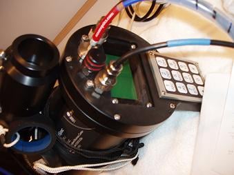
Another boat of scientists travelled to land within the islands in order to deploy large light and dark targets from which the CASI instrument can be calibrated. In order for the CASI sensor to most accurately record the differences in reflectance of the ground substrates (i.e. coral, rock, sand) as well as be able to assign them to appropriate categories during analysis, any interference (i.e dust and particles in the air, water conditions) must be accounted for and removed from the data collected. This is done by deploying targets on land and in water as well as taking optical measurements in the water, collecting a current acoustic profile and data on bathymetry (a measurement of the depth of the ocean floor from the water surface). This information must be taken each time the CASI data is collected as interference changes on a day-to-day basis.
Question for students/food for thought:
What kind of additional interference do you think the scientists may face while collecting CASI data from the airplane? What effect do you think the interference may have on the data collected?
Think of an area that you would like to study. What would make your area a good location for a study? What factors would play a role in choosing an area? What preparations would you need to make in order to accurately study your area?
Additional information:
After setting up the required equipment in the boat the remote sensing team originally intended on using for their data collection, it was determined that in order to most efficiently utilise the equipment, a larger boat would be needed. The braces and cases then had to be reconfigured in order to fit the dimensions of the new boat.
In addition, once the team was on land deploying targets, they found the substrate too hard to penetrate with the metal stakes used to hold down the CASI targets.
Through some improvision, the targets were still able to be deployed and the original plan completed. This adaptability of the research plan and equipment is a vital component to any expedition as the scientific team might be faced with any number of unknown obstacles.

