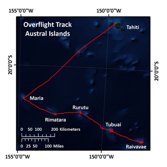
Our final Expedition to French Polynesia takes us to the Austral Islands, the southernmost group of islands located from 500-750 km from Tahiti. We are exploring four small high islands: Raivavae (16 sq. km), Rimatara (8.6 sq. km), Tubuai (45 sq. km), and Rurutu (32.3 sq. km), and one low island, Maria. These islands are estimated to be about 12 million years old, having formed over a volcanic hotspot. The Austral Islands are an extension of a submerged mountain chain that also includes the Cook Islands, our next destination on this mission. The Austral Islands are the most remote, and also the coldest islands in French Polynesia, especially in winter (July-October) when humpback whales reside and reproduce here.
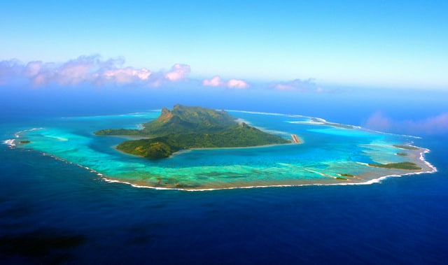
Raivavae, with a population of just over 1000 people, has three main villages. These are concentrated near the coast, at the base of Mt. Hiro, a 437 m tall extinct volcano. The island is surrounded by a very large and shallow lagoon with a shallow passage to the open ocean on the northern end.
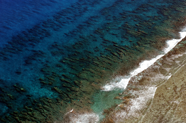
Rimatara, also with 3 main villages and about 950 inhabitants, consists of a small, fertile nearly circular volcanic plateau. The plateau is covered in dense forest vegetation and is surrounded by an 8-10 m tall, uplifted fringing reef. The tallest point (Mt. Uahu) rises from the coast to about 106 m.
Tubuai, the administrative capital of the Austral Islands, has the largest population in the Australs (approx. 2050), with most residing in one main village. Tubuai is an extinct volcano with two volcanic domes. The domes form a group of mountains demarcated by faults (a “massif”), culminating in a 422 m high peak (Mt. Taita). The east coast is an uplifted coral reef adjacent to a circular lagoon and white sand beaches.
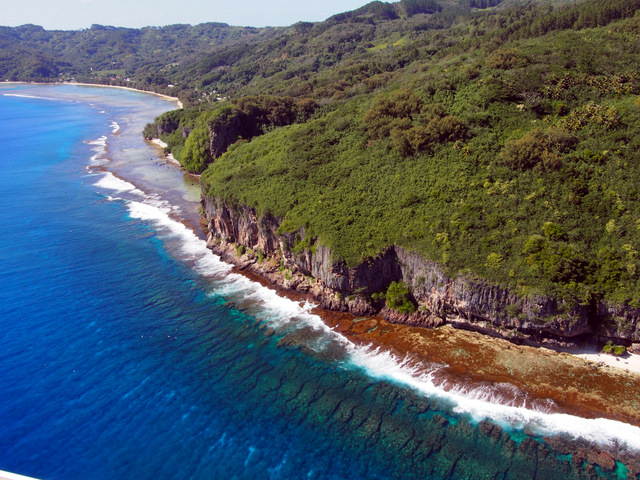
Rurutu is most different from the other Austral islands in the archipelago. Its structure is formed by an ancient coral reef that was uplifted (known locally as a makatea), to create sheer, karst-eroded limestone cliffs. These karstic cliffs are pock-marked with giant stalactite and stalagmite-filled caverns, caves and grottoes. The larger caves found here once supported ancient settlements, and their remains can be seen through numerous burial grounds, ancient marae (sacred places) and numerous artifacts and treasures. The island is fringed by a continuous coral reef, so there’s no lagoon. There are, however, lots of bright white coral sand beaches. The highest point, Mt. Maureva, rises to an elevation of 398 meters. Approximately 2015 people inhabit three main villages.
Maria is a small atoll with four densely forested islets and a very shallow lagoon. It is uninhabited. Once, long ago, Maria supported a penal colony.

The high islands are well known for their traditional art of weaving of coconut and pandanu leaves into hats, purses, mats and baskets. The fertile soil supports a wide variety of crops including potatoes, taro, coffee, vanilla and bananas, as well as coconut palms. The largest and most productive giant clam fishery in French Polynesia is located in the Austral Islands.
As we complete our aerial surveys of the Austral Islands, the M/Y Golden Shadow is en route to Raivavae, where we begin our coral assessments.
(Photos by Andrew Bruckner)
To follow along and see more photos, please visit us on Facebook! You can also follow the expedition on our Global Reef Expedition page, where there is more information about our research and team members.

